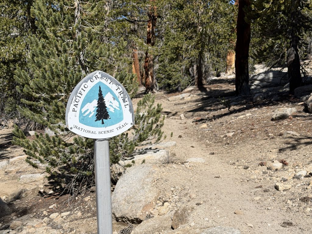
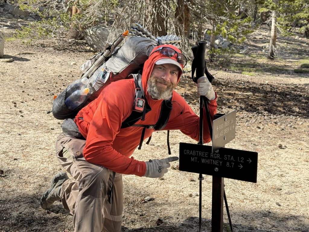
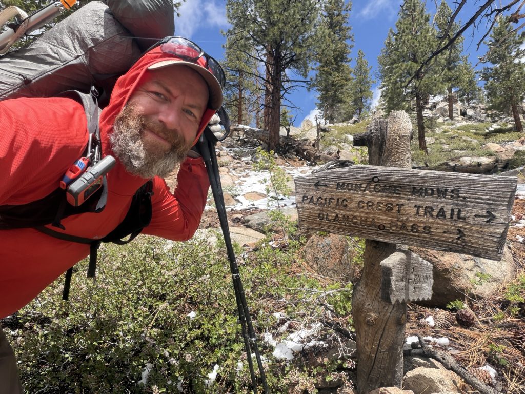
PCT Day 59 – Tyndall Creek (775.9) to Kearsarge Lake via Bullfrog Lake Trail.
June 2, 2026
Total PCT miles: 13.7
Non PCT miles: 1.7
Total: 15.4 miles / 24.8 km
Total elevation gain: 3999 ft
Total elevation loss: 4009 ft
Steps: 38009
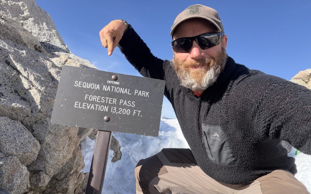
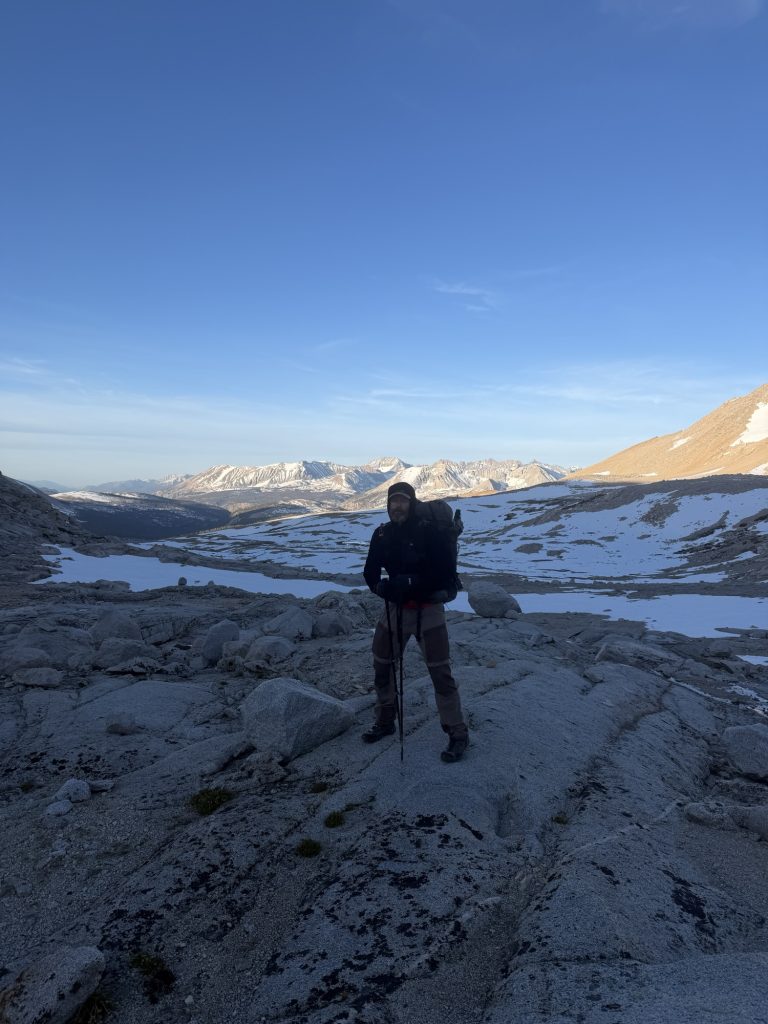
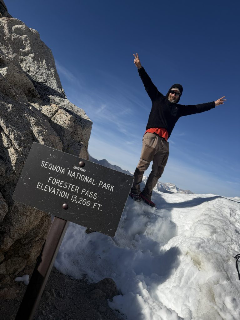
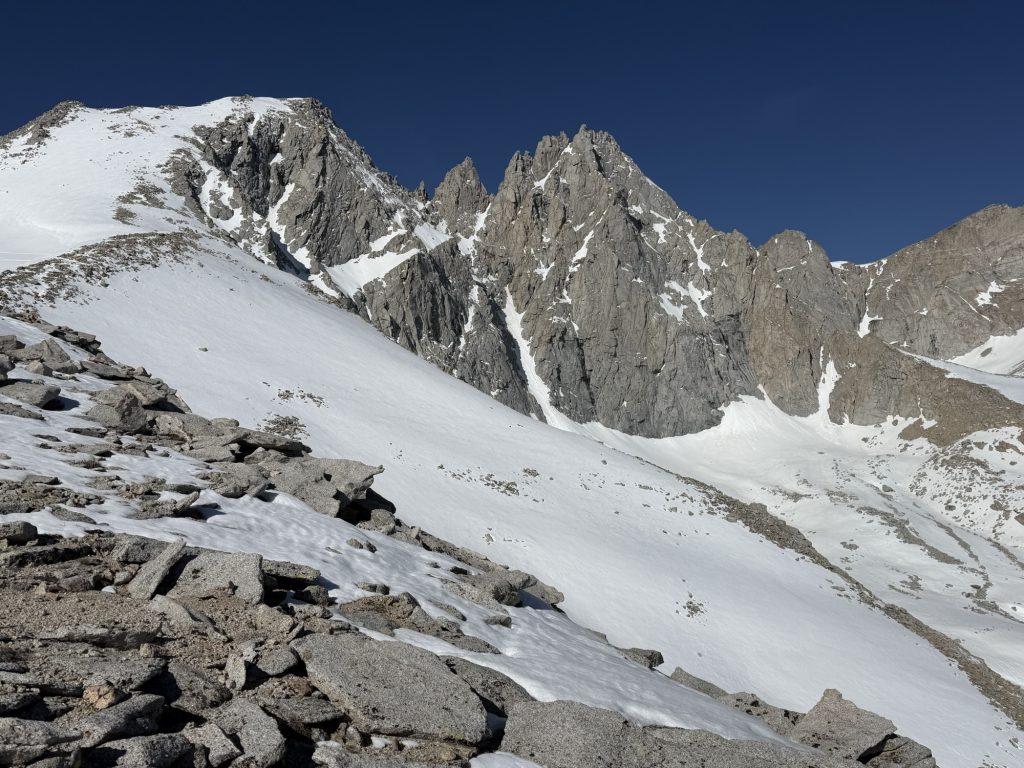
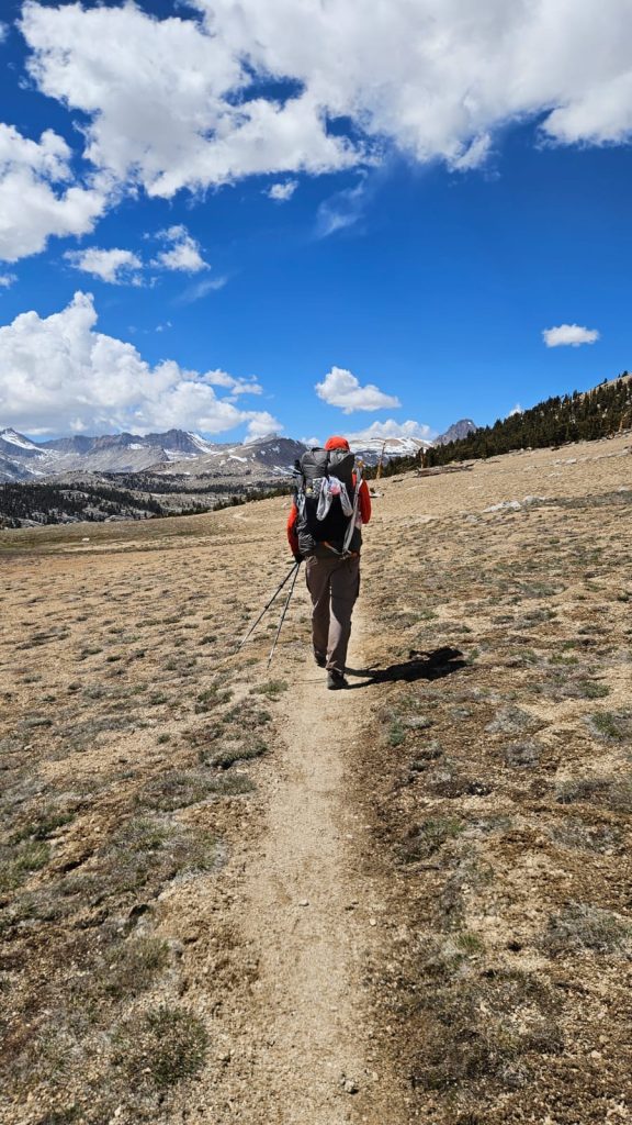
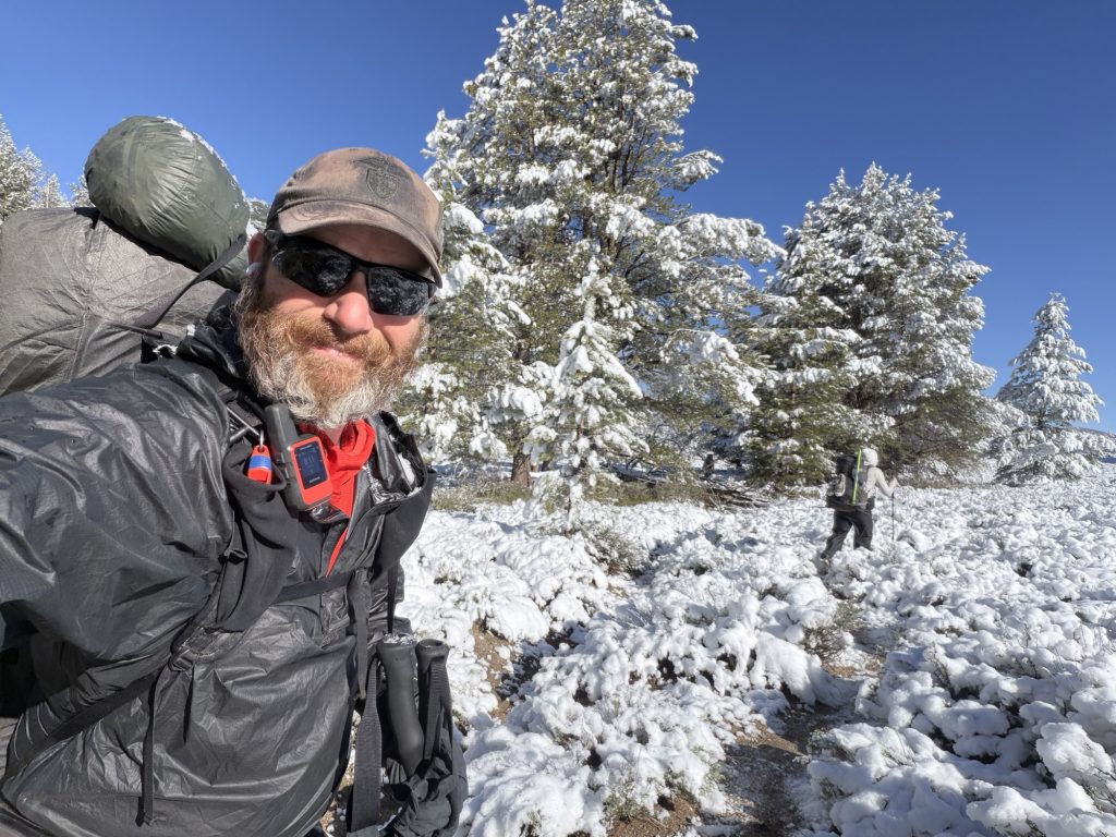
Today was the day we climbed Forester Pass, the highest point on the PCT at 13120 ft. It’s early season in the Sierra which means there is still plenty of snow on the approach and even more on the backside of the pass. This is why I have been carrying an ice axe (that I hope not to need) and microspikes (which I will definitely require).
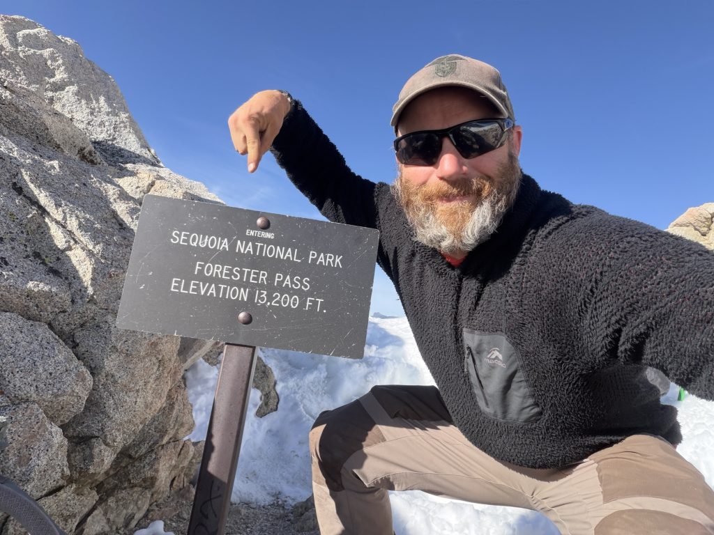
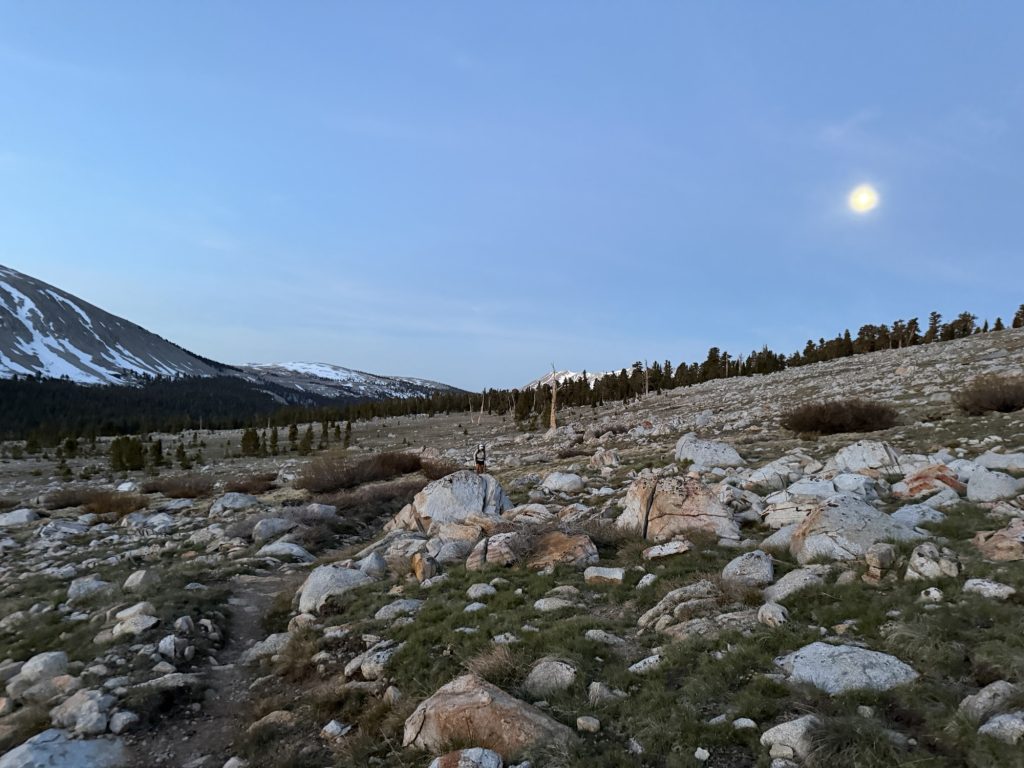
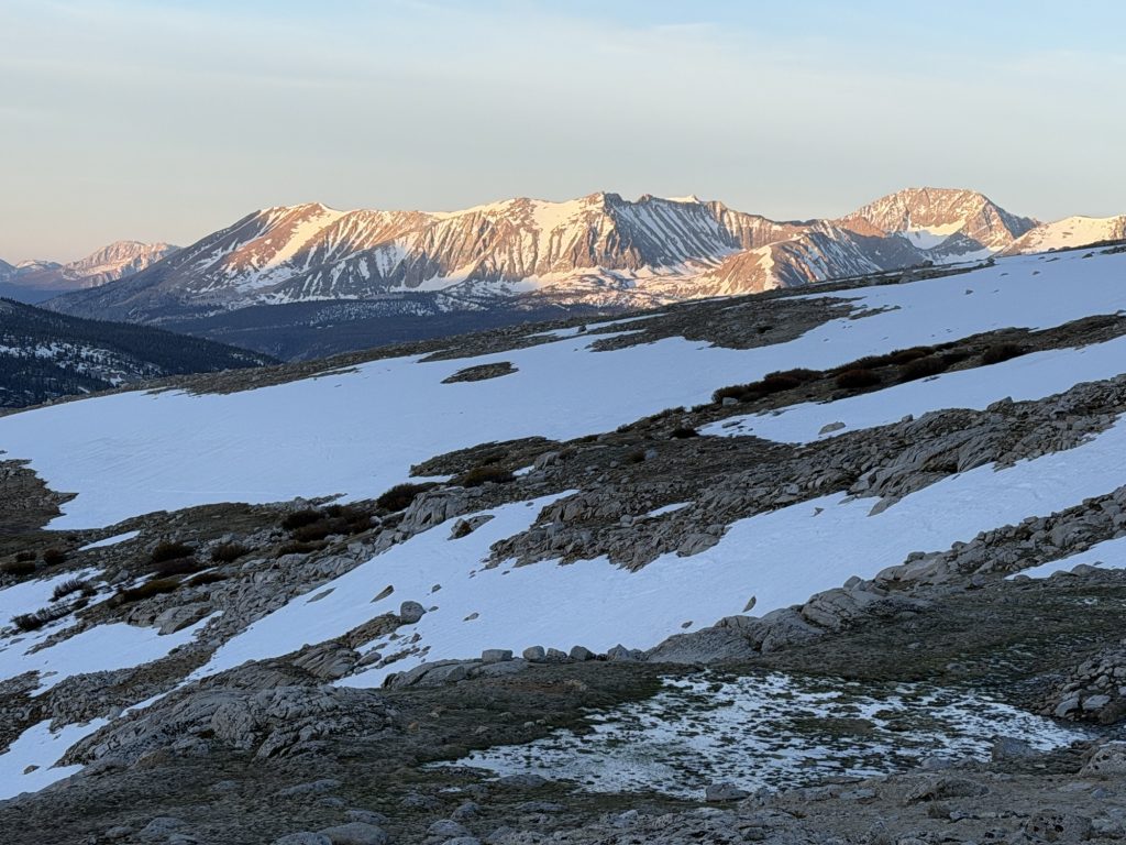
The best strategy for any snow covered pass is to summit early. This provides firm snow for microspikes and prevents postholing. Ultimately it makes for a much more pleasant and less energy sucking journey. I was up at 0400 after a not so great sleep and our group set off at 0500 for the 4.7 mile, 2000 ft accent. The almost full moon providing more than enough light to guide our way and paint the surrounding mountains in a pale peaceful wash.
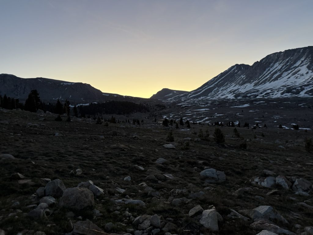
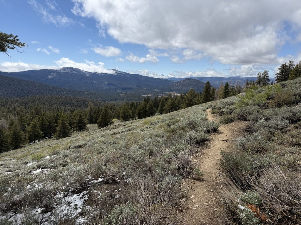
The first 1000 ft was a very gentle accent occasionally walking across patches of snow and ice As the view of the switch backs and saddle came into view. Behind us the alpine glow of the rising sun started to illuminate the mountains we had hiked passed yesterday. The switch backs up to the the saddle and the remaining 1000 ft of elevation were 50% snow covered and 50% bare requiring microspikes for safety.
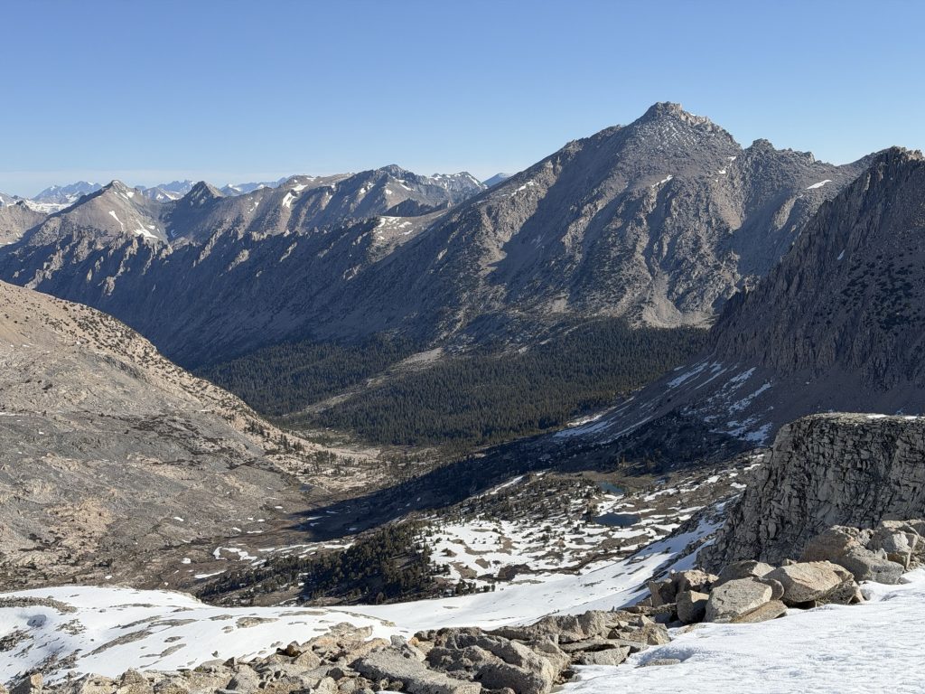
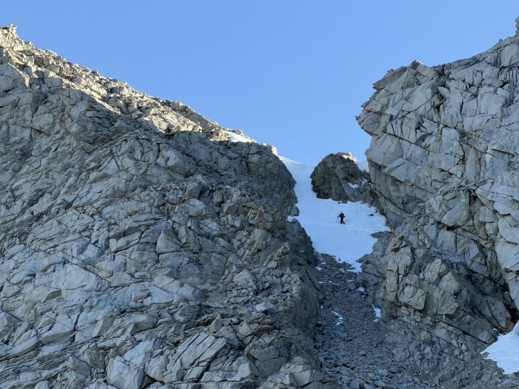
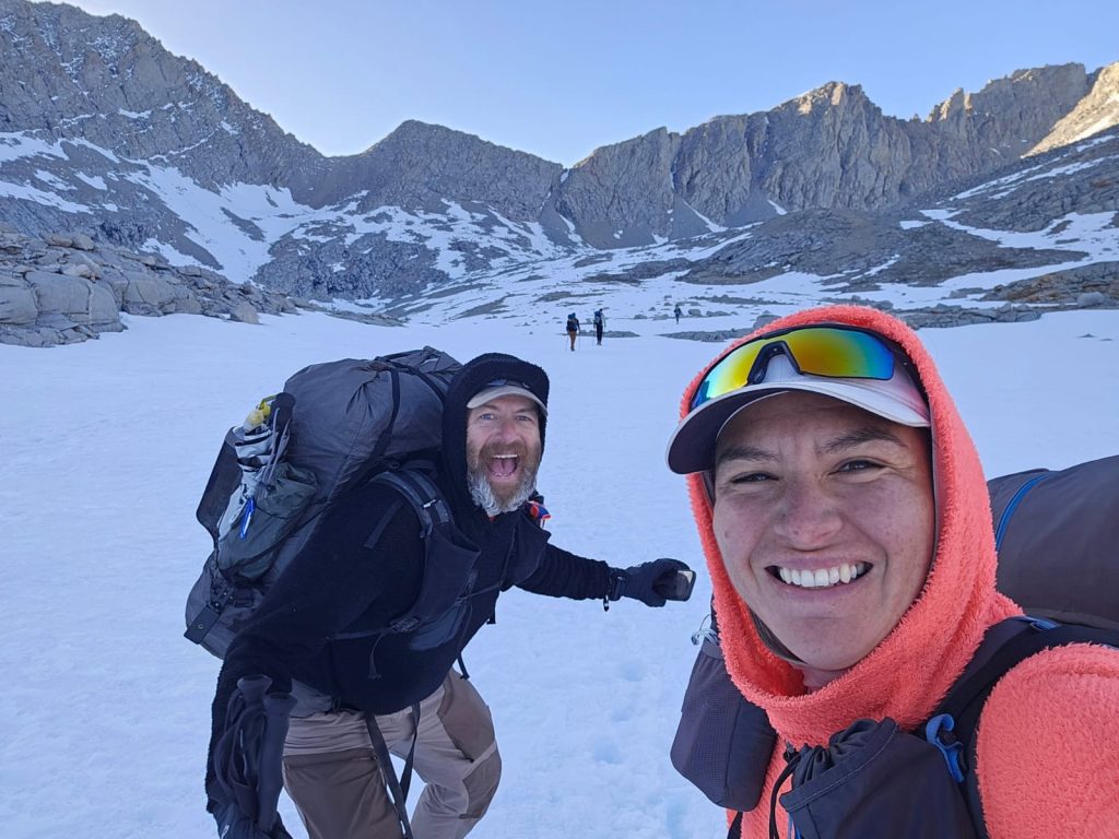
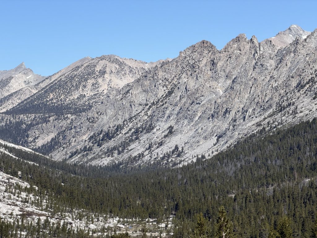
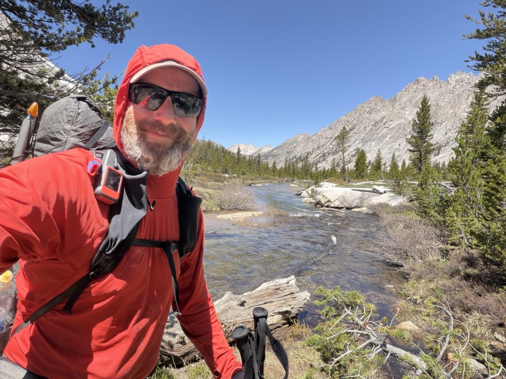
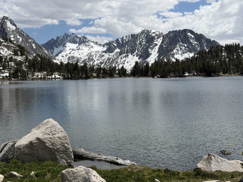
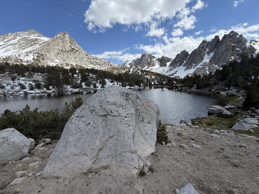
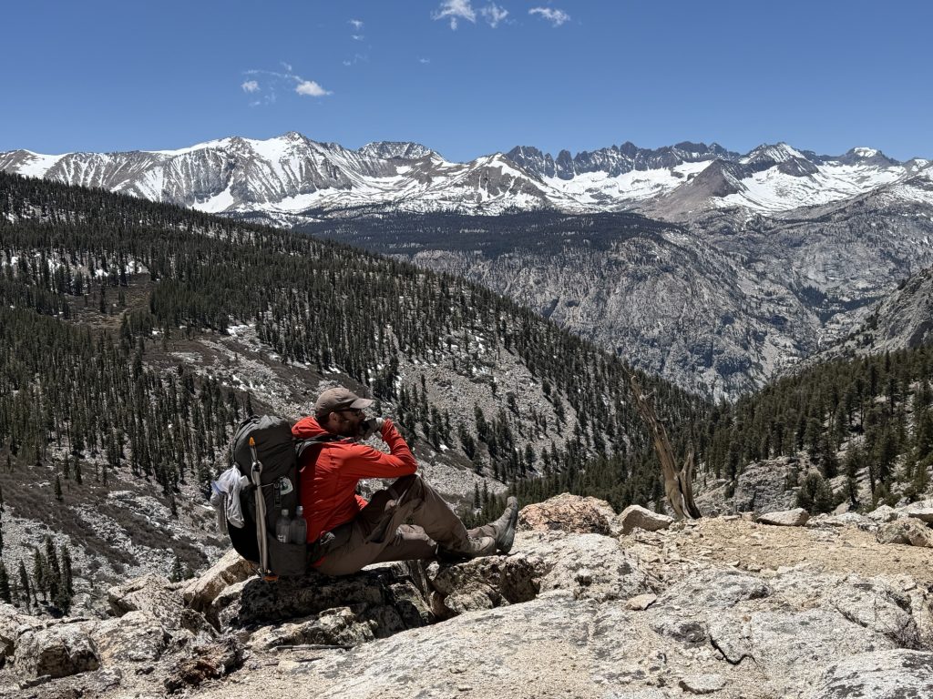
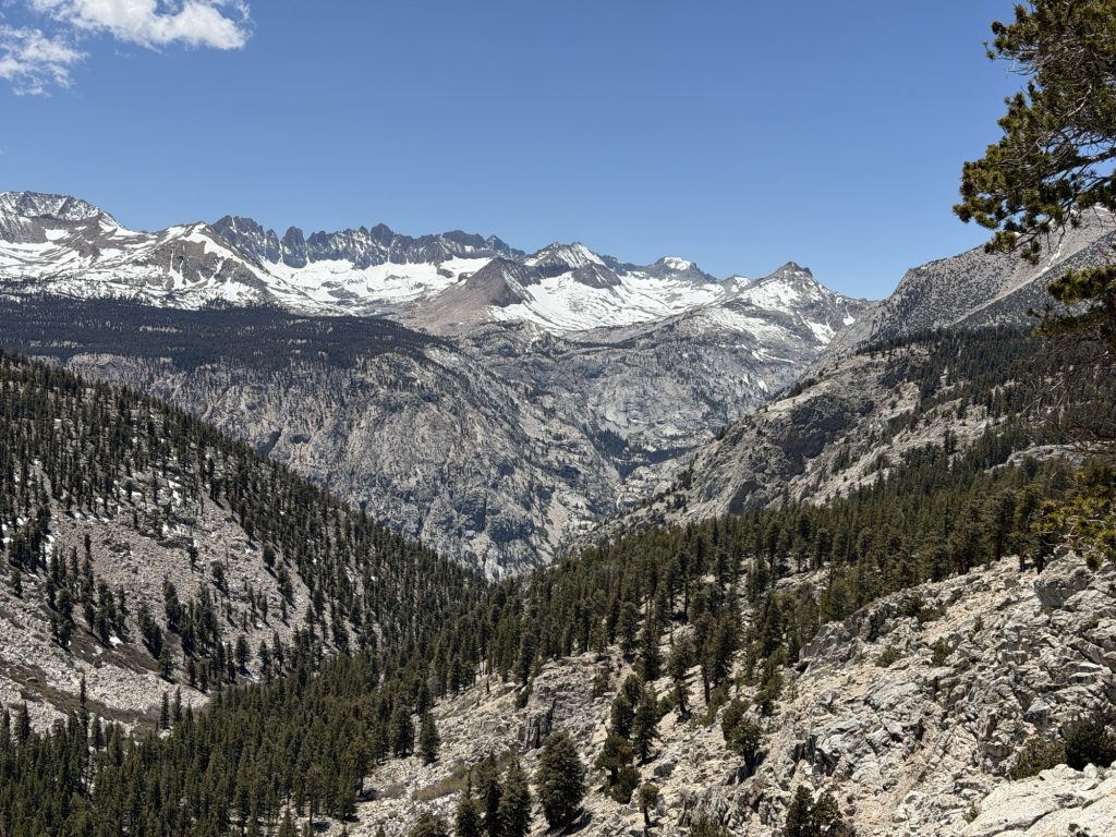
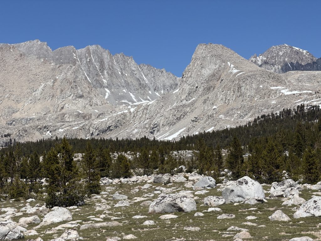
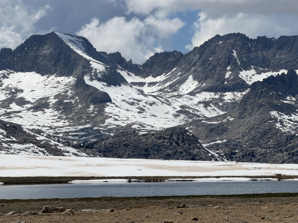
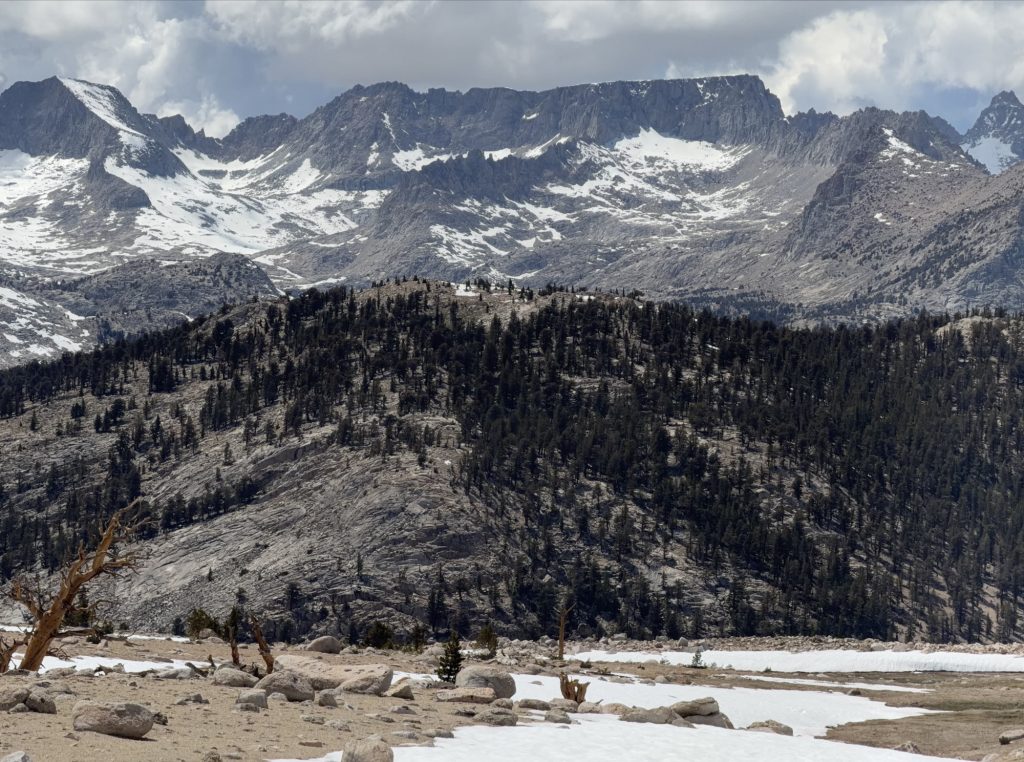
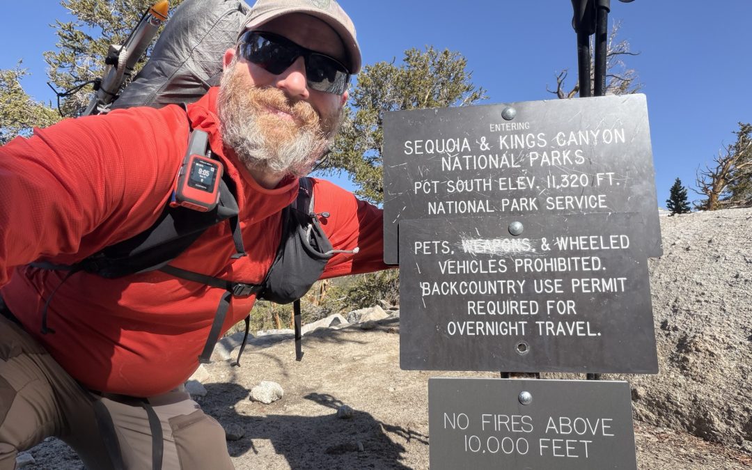
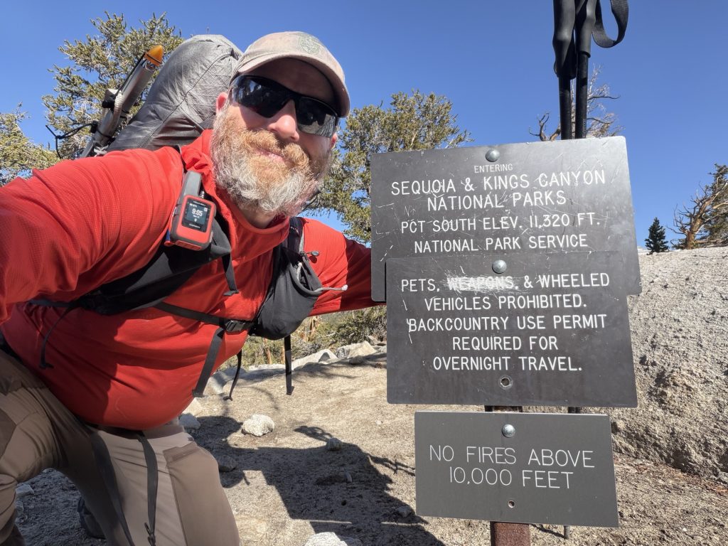
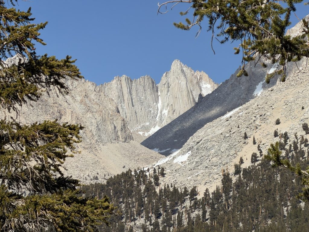
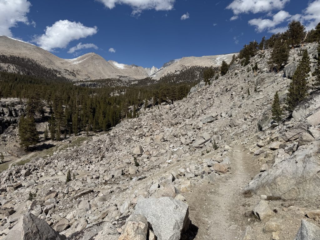
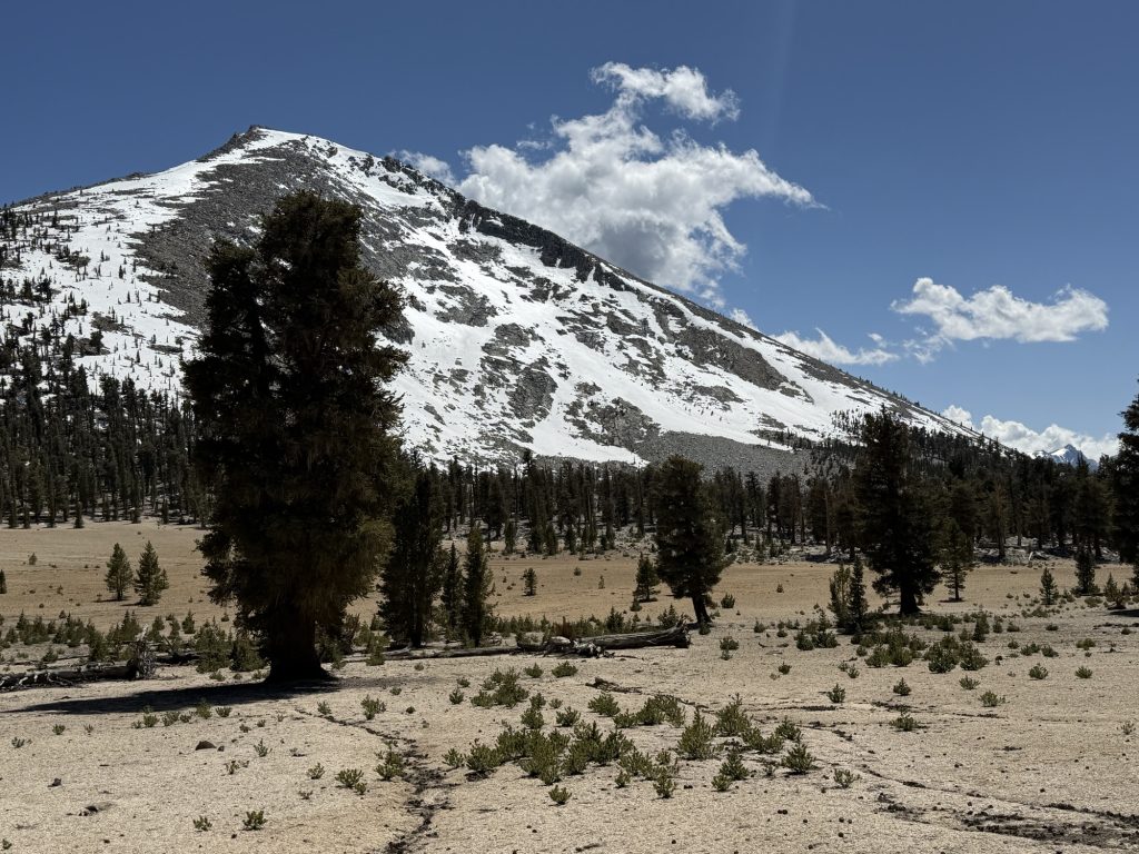
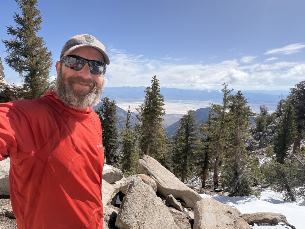
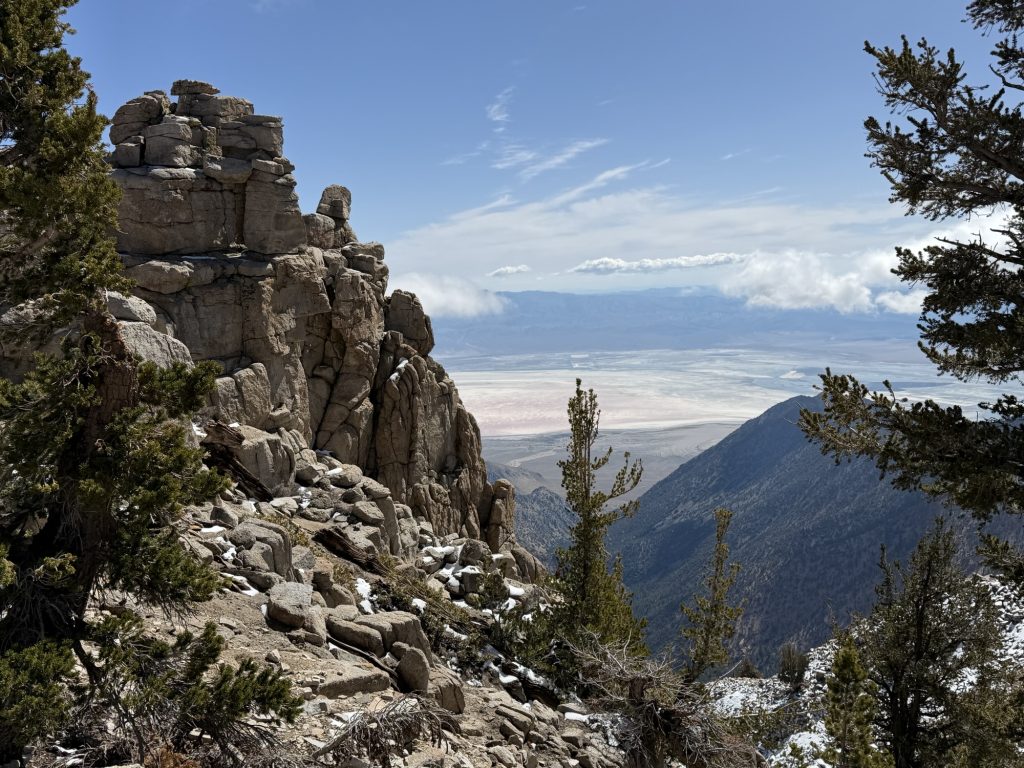
Now at over 12000 ft breathing became more and more laboirious and my steps became shorter and shorter as I slowly approached the sketchiest part of the journey. Forester Pass is known for its ice chute that in the early season covers about 20 meters of trail. One fall here and you’ll skid down the ice a few hundred feet before hitting rocks. This is why I have been carrying an ice axe. To help me cross safely or self arrest before hitting the rocks should I fall. The conditions today didn’t really require me to use the ice axe, I could have probably crossed just as safely with only my trekking poles but I had the axe so I used it anyways crossing without much hesitation. A final switch back and there I was on top of Forester Pass the highest part of the PCT. Behind me Seqoia National Park and before me Kings Canyon National Park. It’s all “downhill from here all the way to Canada”.
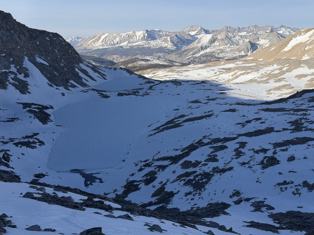
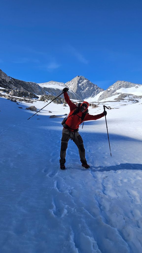
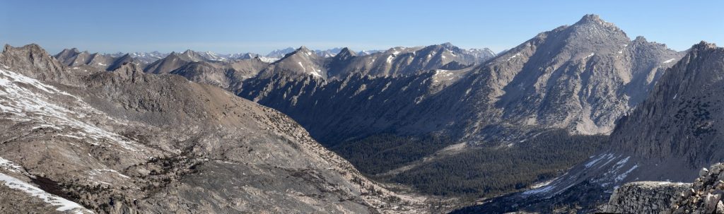
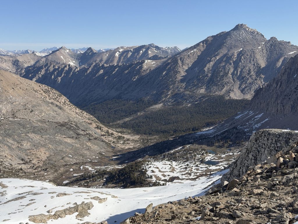
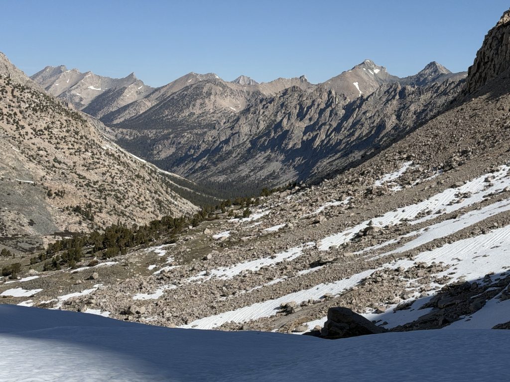
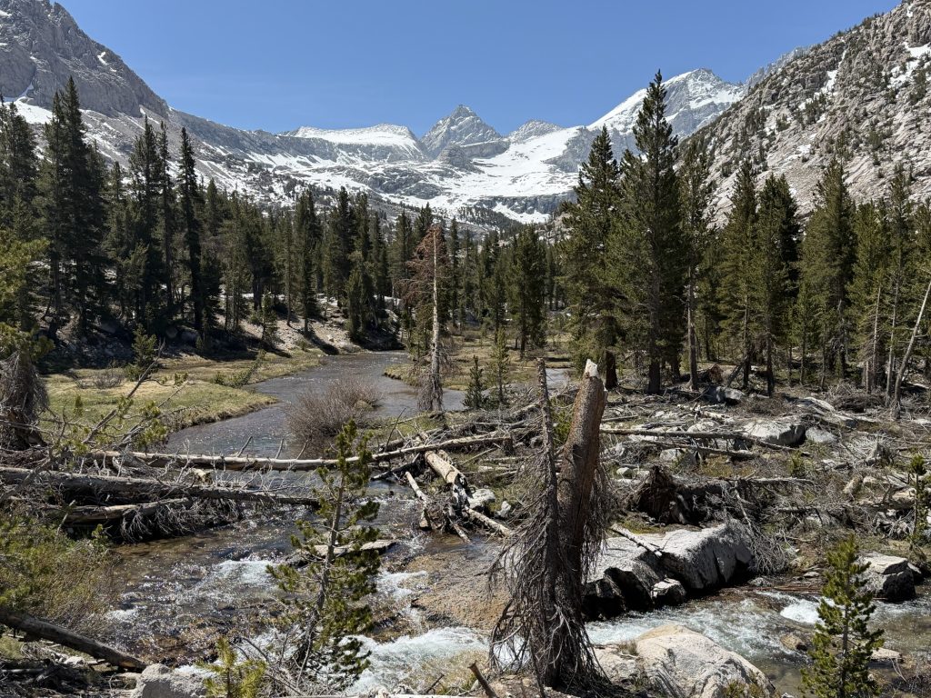
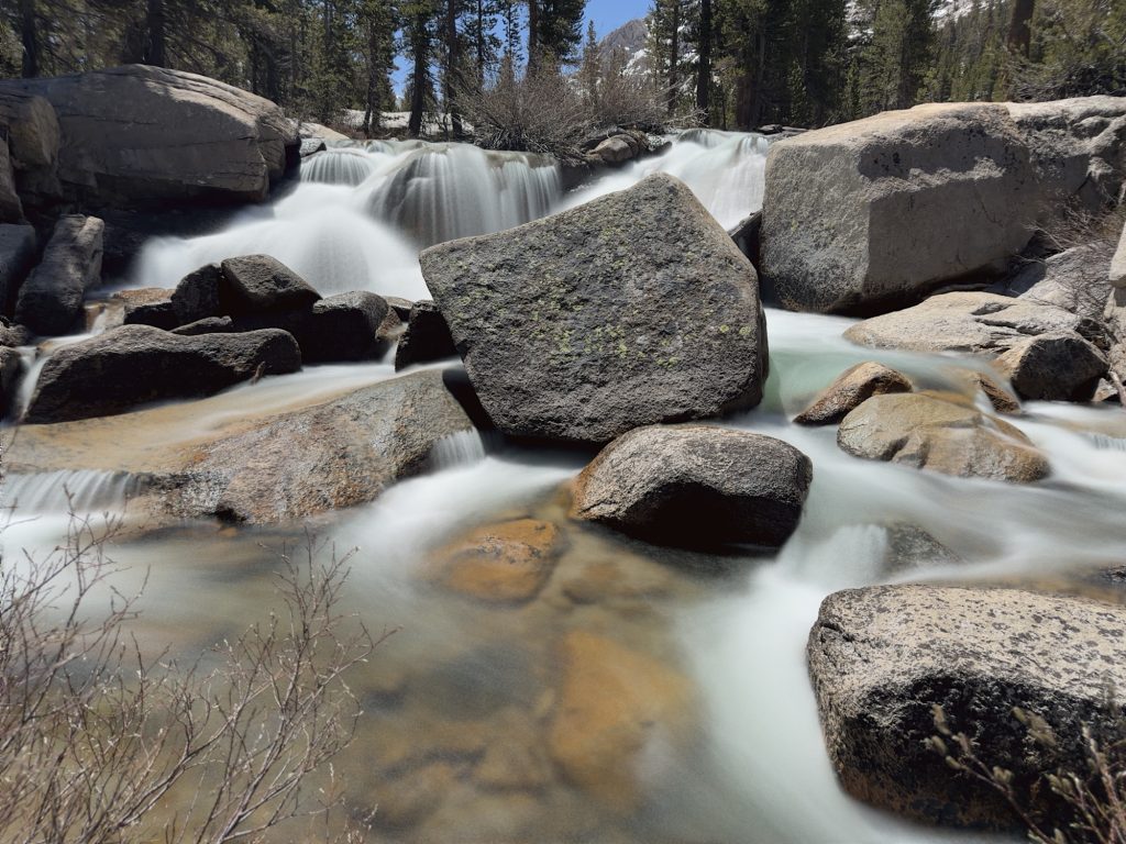
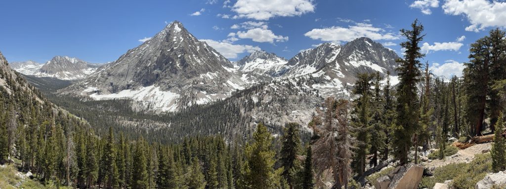
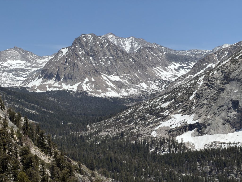
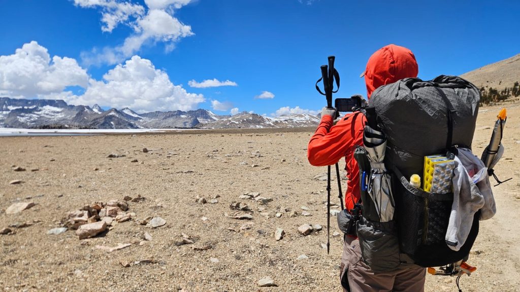
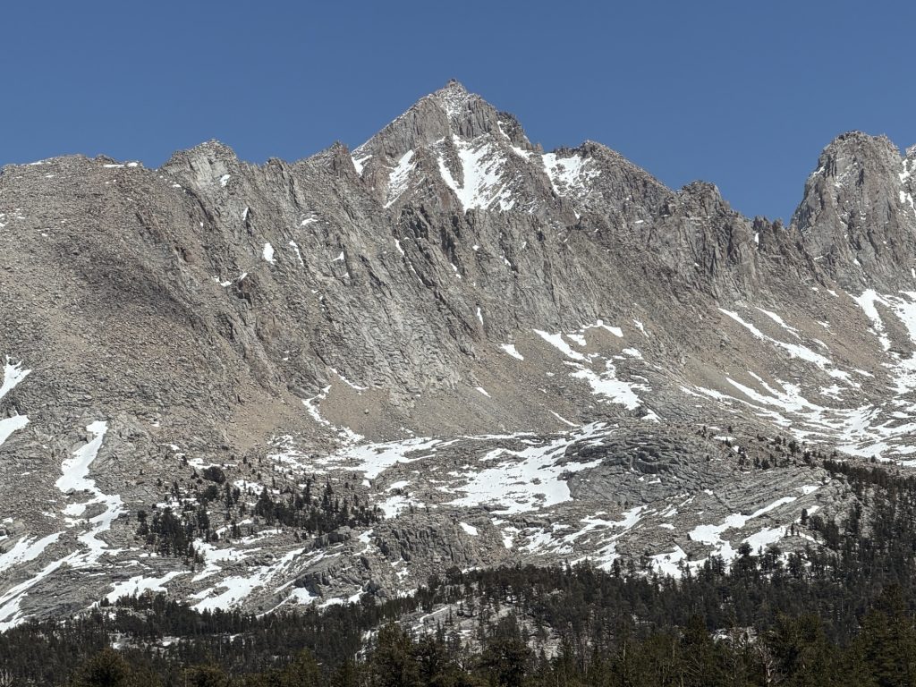
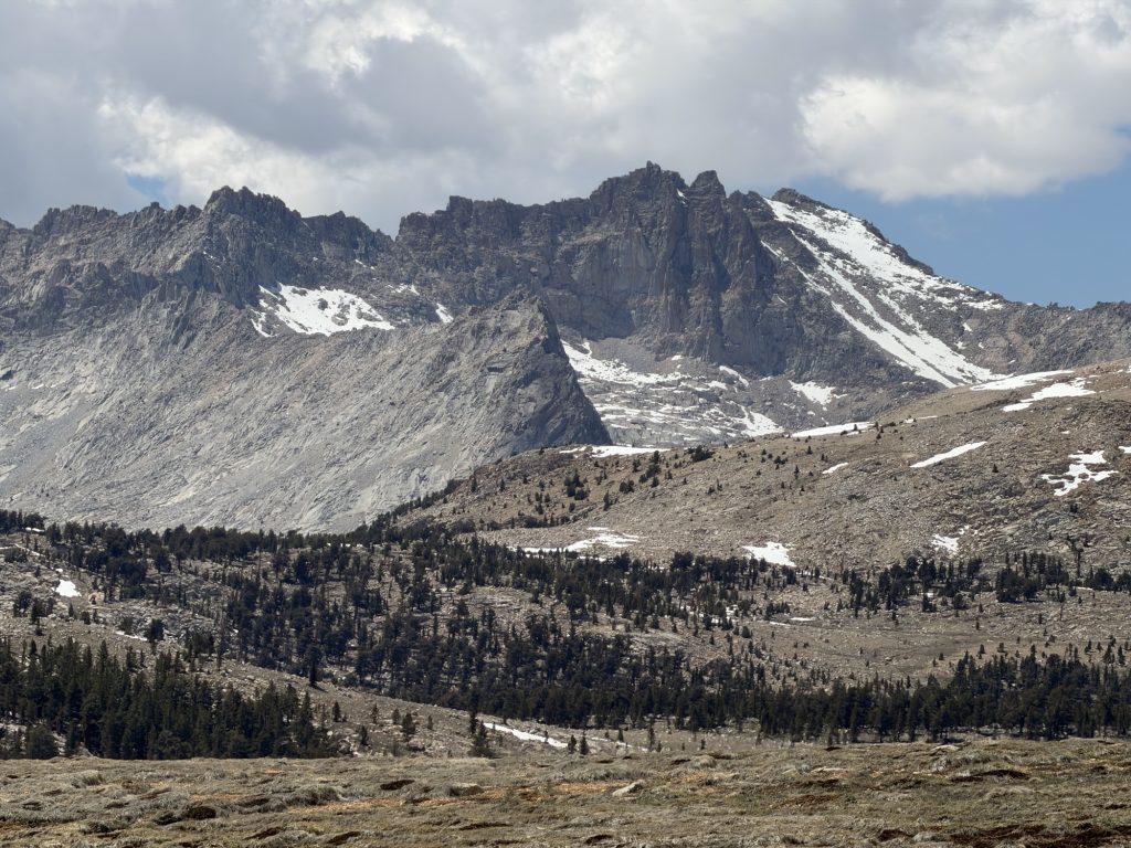
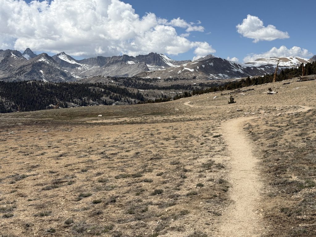
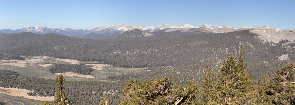
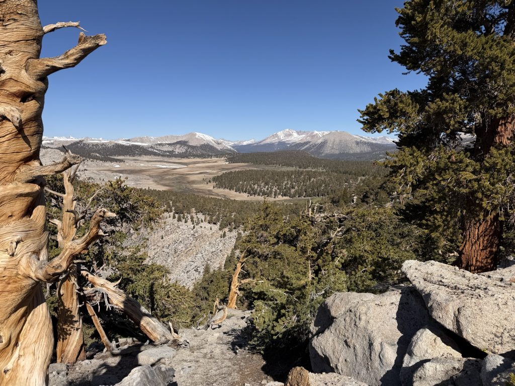
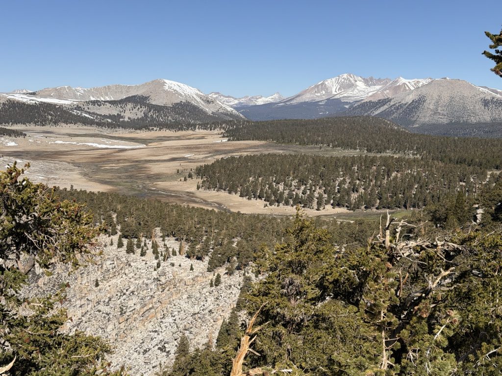
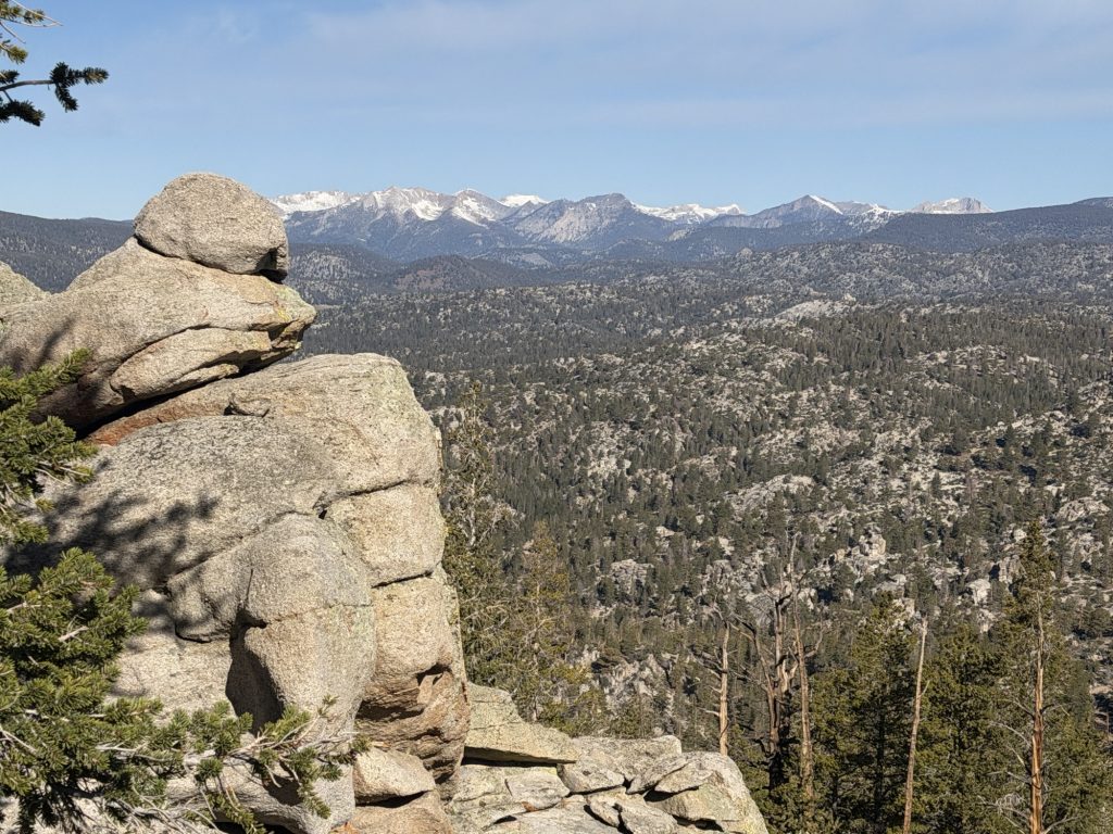
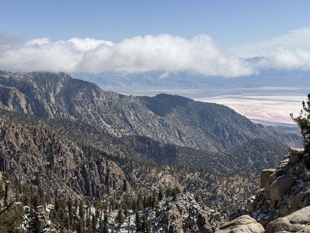
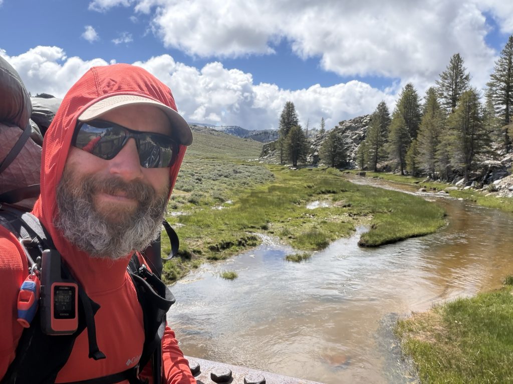
The mountains and Kings Canyon before me were absolutely breath taking. The trail gently decends into the canyon below. The first few miles all covered in snow. Thankfully we had reached the pass at 0745 and the sun had yet to really soften the snow so no postholing was to be had. There were good boot tracks to follow including some going the wrong way. The maping feature on my watch was very helpful in ensuring i remained on trail.
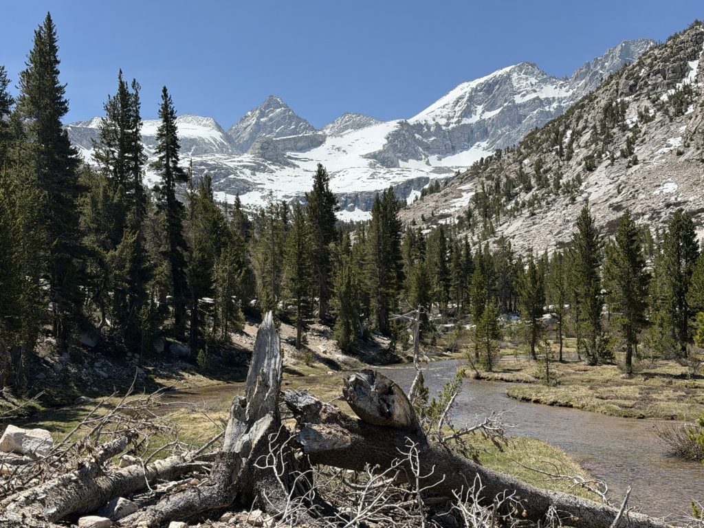
As I decended into the canyon the temperature increased and my breathing was much improved. The most challenging part was watching my step instead of the scenery around. We stopped a few times to eat, rest or just admire the views. On one of these breaks I noticed that my hip belt on my pack is holding on by a thread. Hopefully it makes it until I can replace it in town.
From the bottom of the canyon starts a real steep climb up to the Bullfrog lake trail. On the way we met a hiker who had left Kennedy Meadows two days earlier and hiked through the entirety of the winter storm. His story was wild and I’m glad that we had waited out the worst of it.
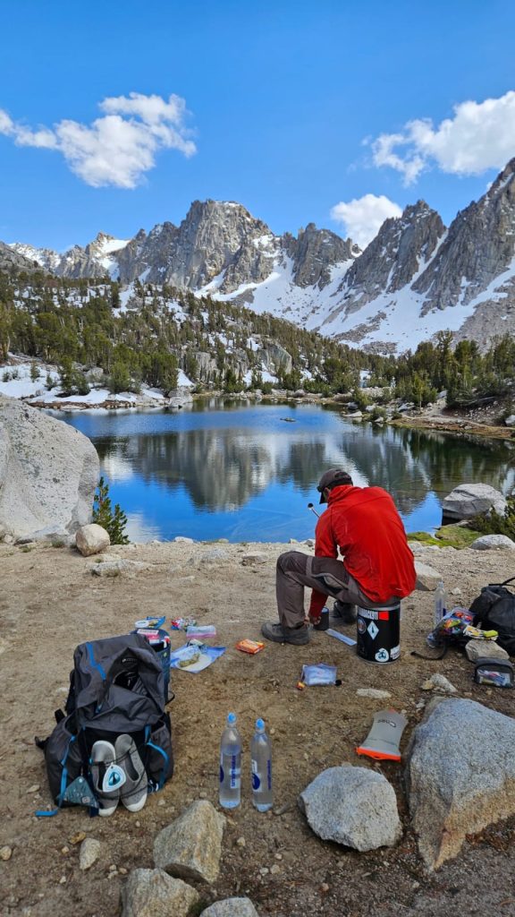
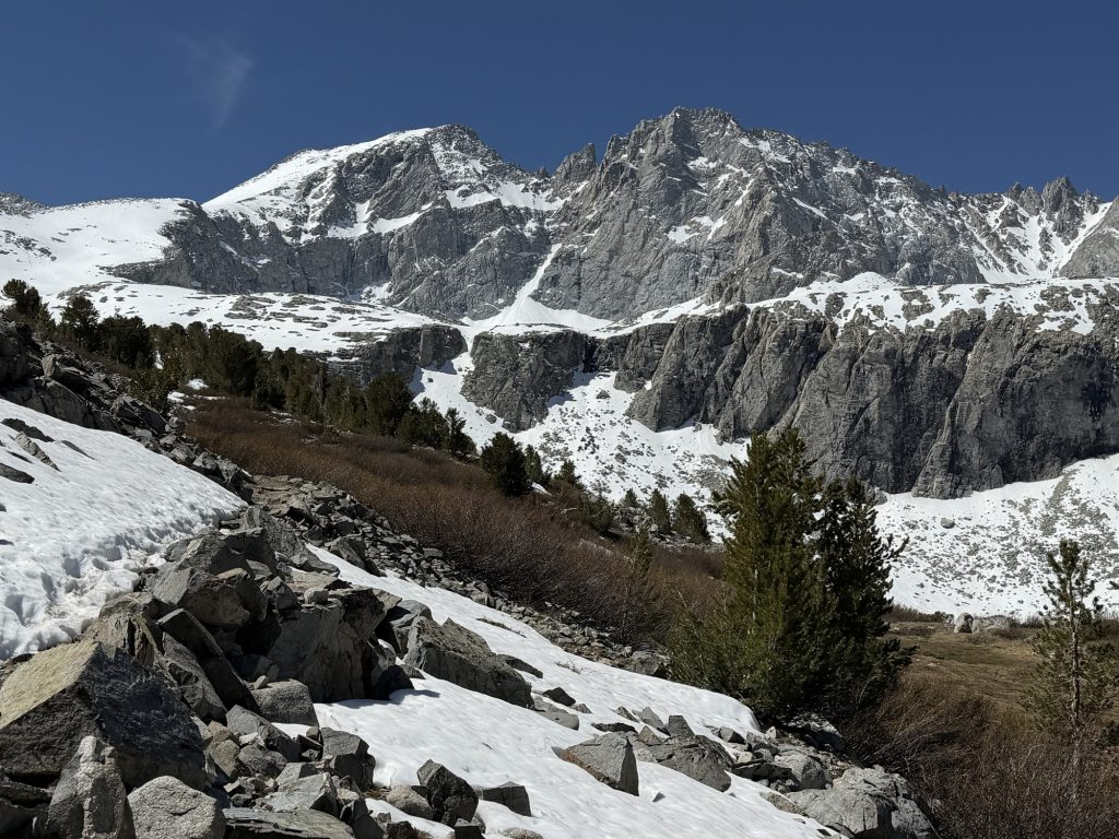
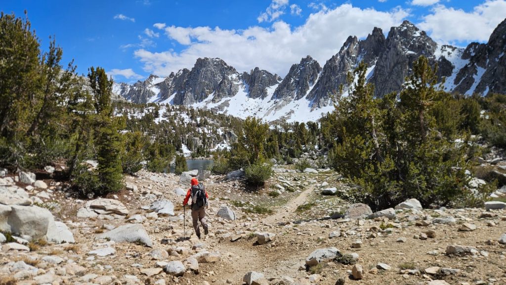
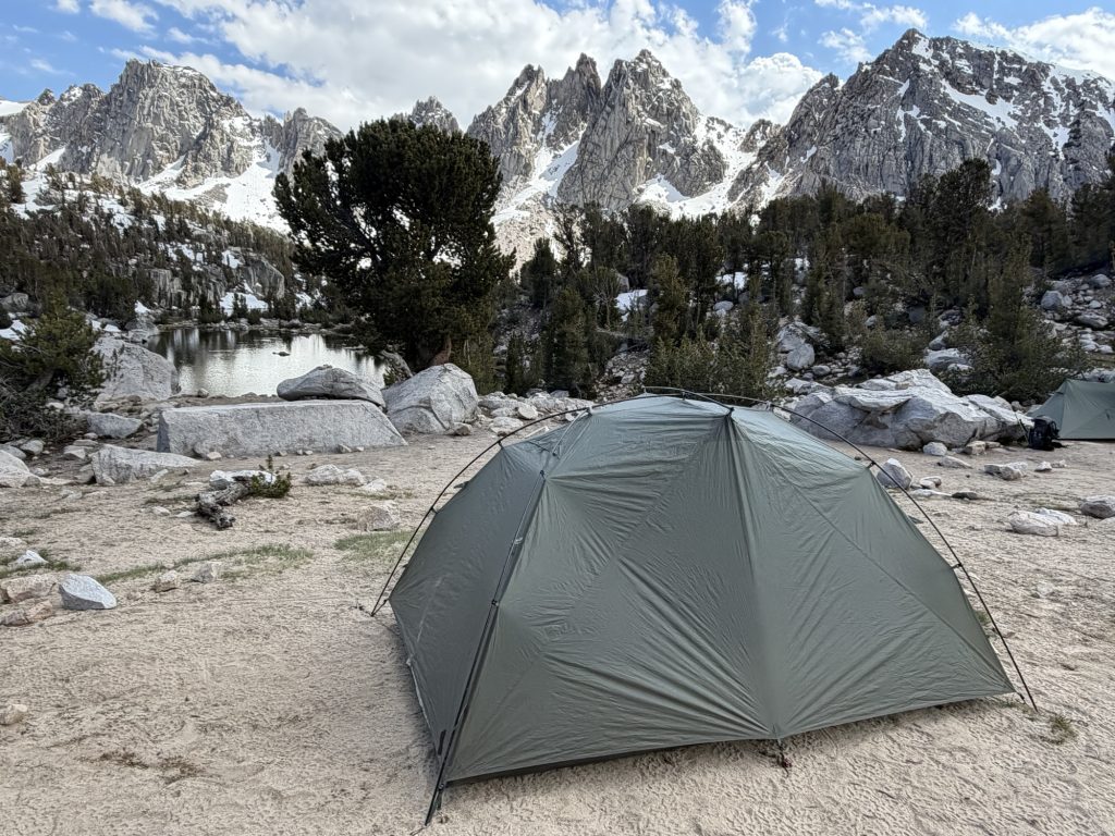
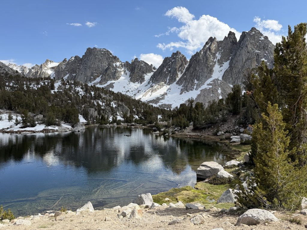
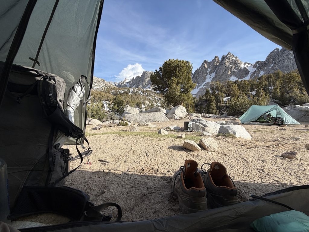
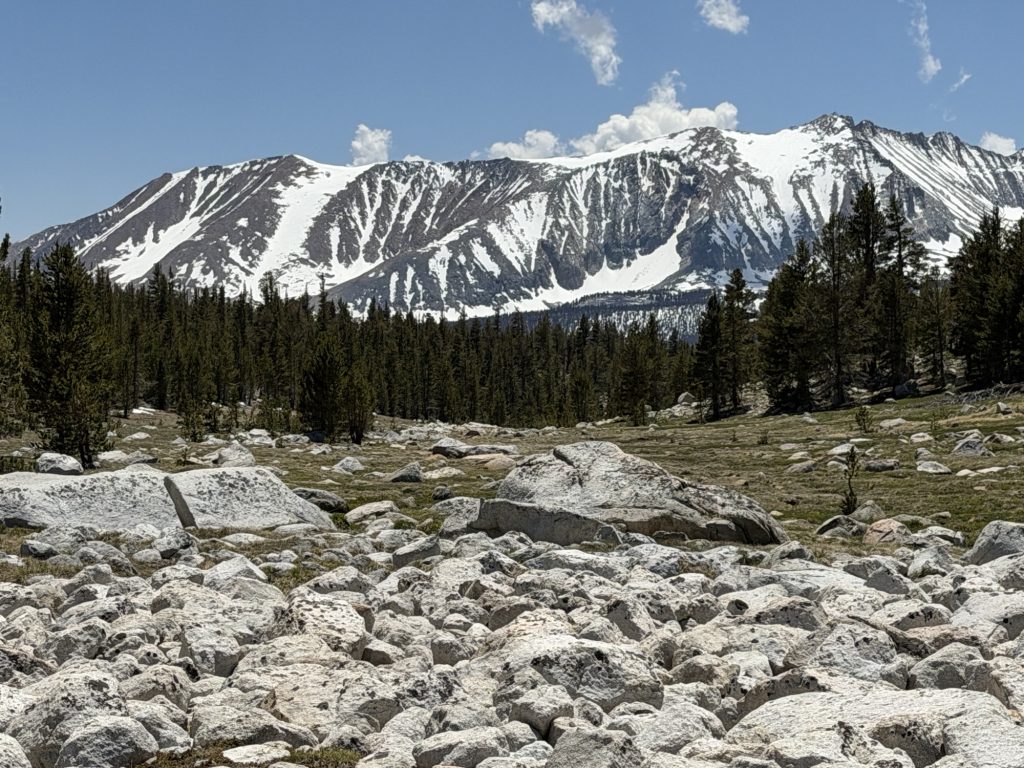
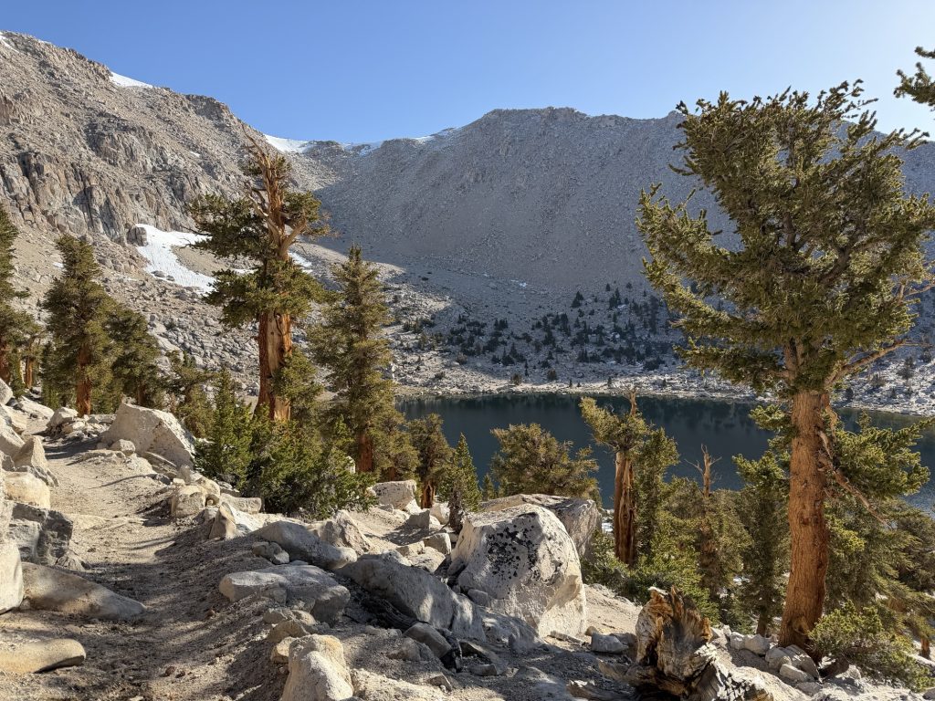
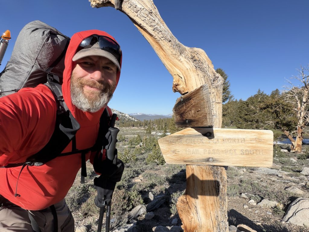
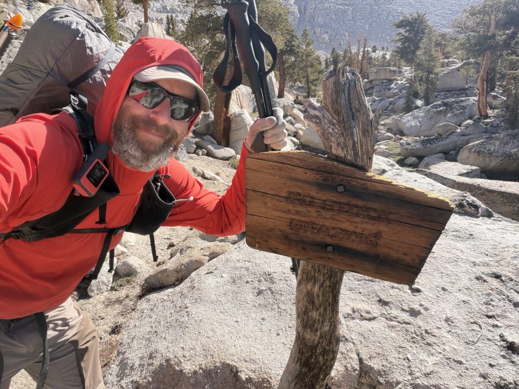
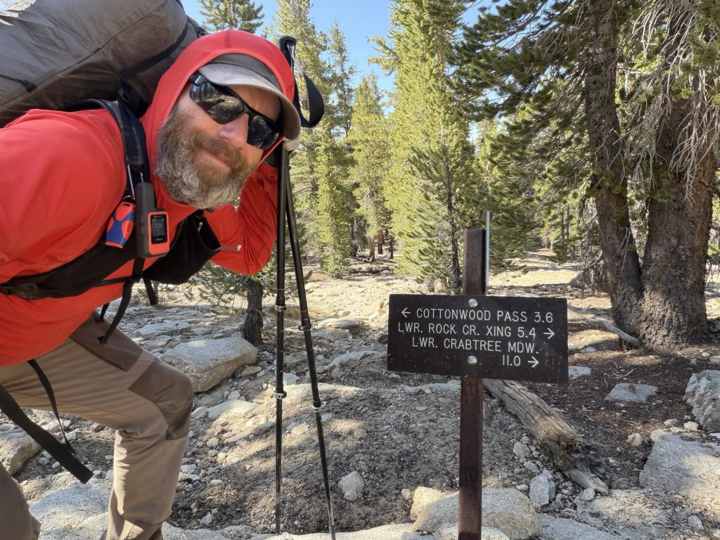
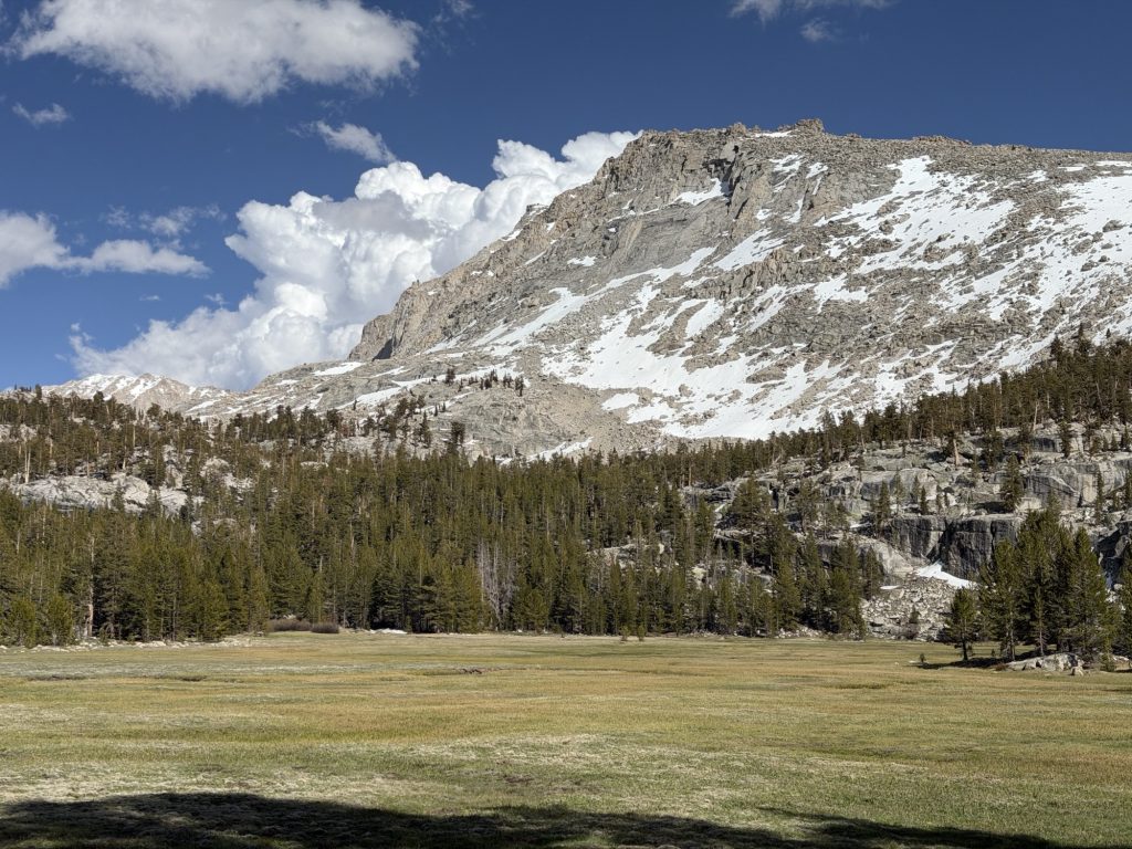
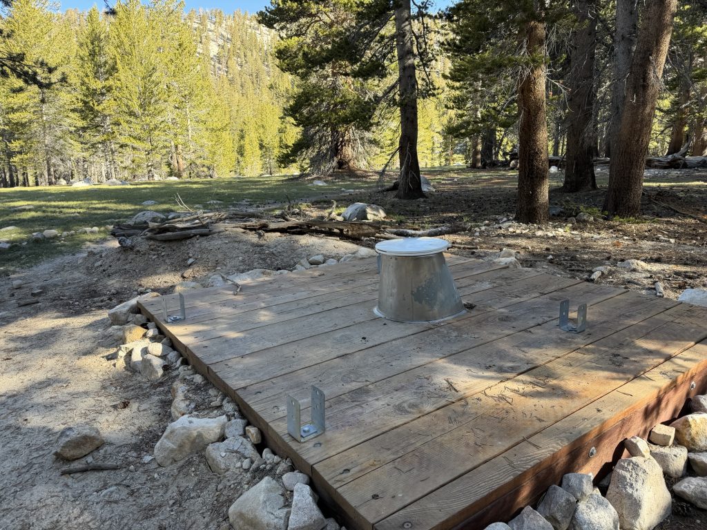
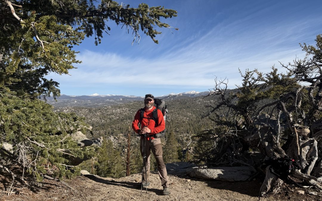
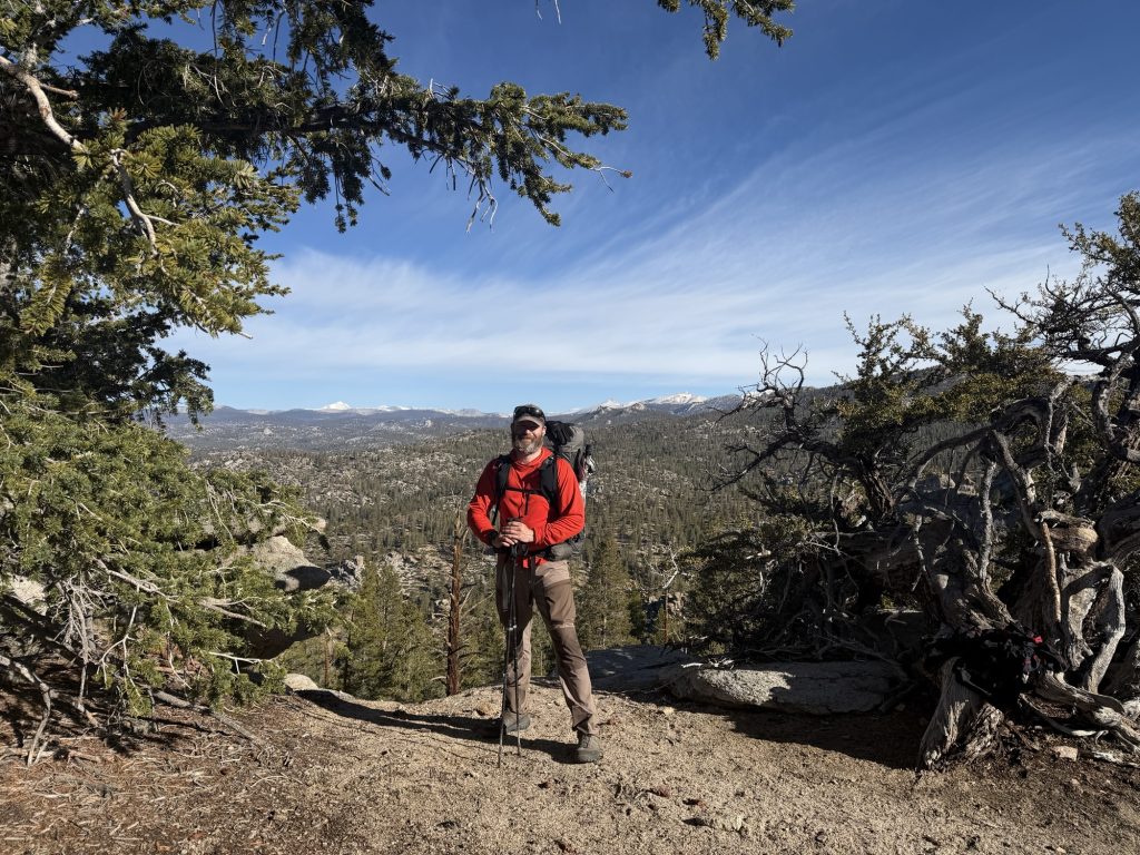
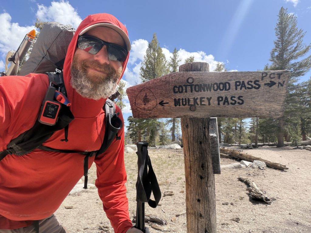
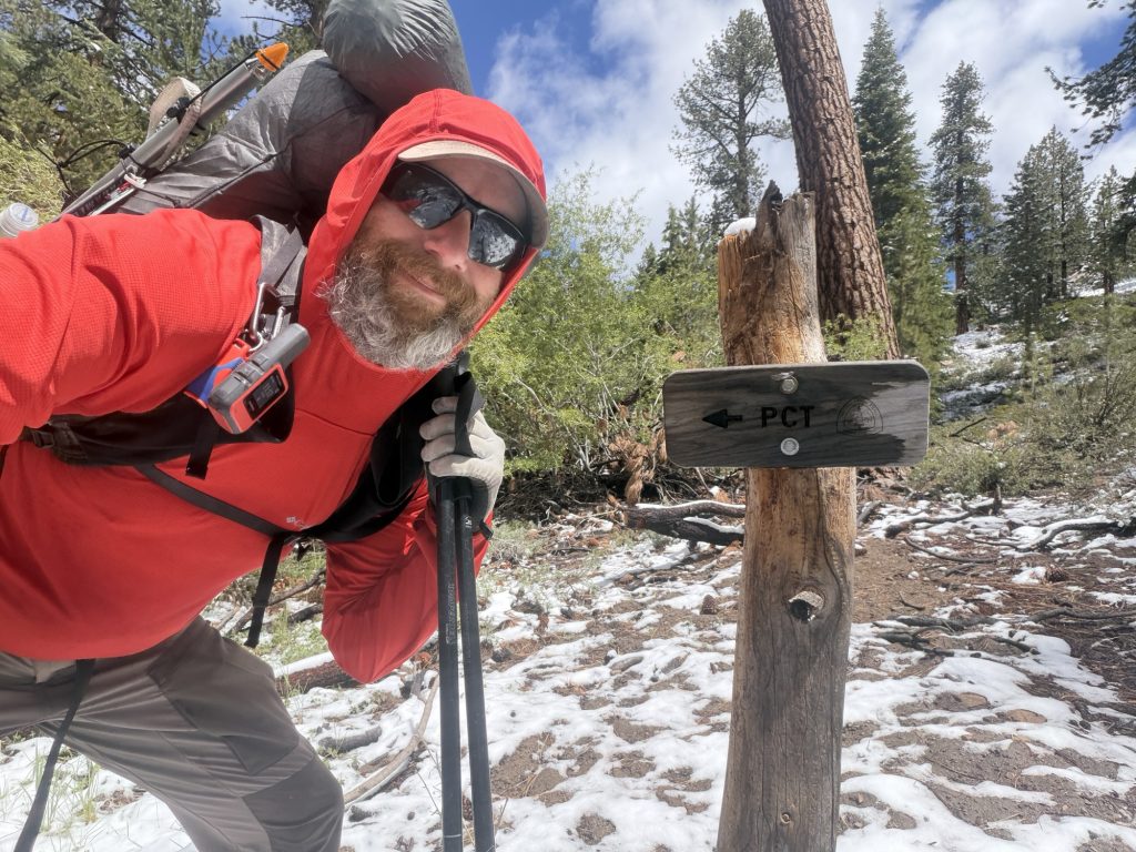
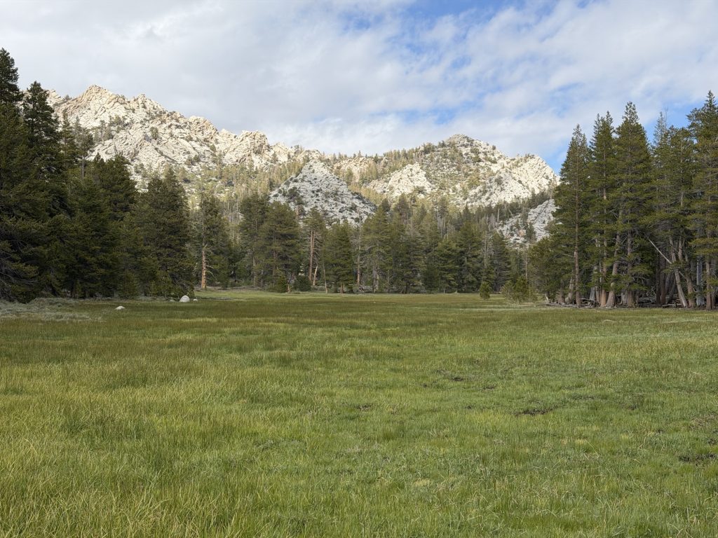
Tomorrow we are going into the town Bishop for some much needed real food, rest, resupply and showers. Apparently there is an amazing deli in town and I have been fantasizing over the sandwich I will destroy when I get there. We have a ride scheduled to pick us up at the trail head at 10:30 so we decided to take the Bullfrog lake trail and camp at Kearsarge Lake. This has to be the most beautiful place I have ever had the pleasure of setting up my tent. We arrived at 1530 and had plenty of time to relax and enjoy the scenery. Later we were joined by two other hikers which made for great conversation about our trials and tribulations over the past few days.
PCT Day 58 – Crabtree Meadows (767.5) to Tyndall Creek (775.9)
June 1, 2026
Total PCT miles: 8.4
Non PCT miles: 1.1
Total: 9.5 miles / 15.3 km
Total elevation gain: 1946 ft
Total elevation loss: 1640 ft
Steps: 23169
What a difference a day and a change of pace can make. Ultimately I decided against an early morning start and sumitting Mount Whitney. I would have preferred to have done the summit but I was in no physical or mental state to do it. It would have just been miserable and only served to continue to darken my mood. Instead of getting up at some ungodly hour and completing an exhausting zombie hike I slept… decently until 0700.
When I got out of bed I learned that Ness had also made the decision not to do the early morning death march. We decided together we would have a lazy morning, leave camp around 10ish and hike to Tyndall creek. This would put us in good position to hike Forester Pass, the offical highest pont on the PCT, the next day.
The extra sleep, combined with the relaxed pace really lifted our spirits. Hiking 18 plus miles a day in the Sierra is grueling both physically and mentally and I personally can not recommend that approach unless you are an athlete. I am far away from being an athlete and even my ability to embrace the suck has its limits.
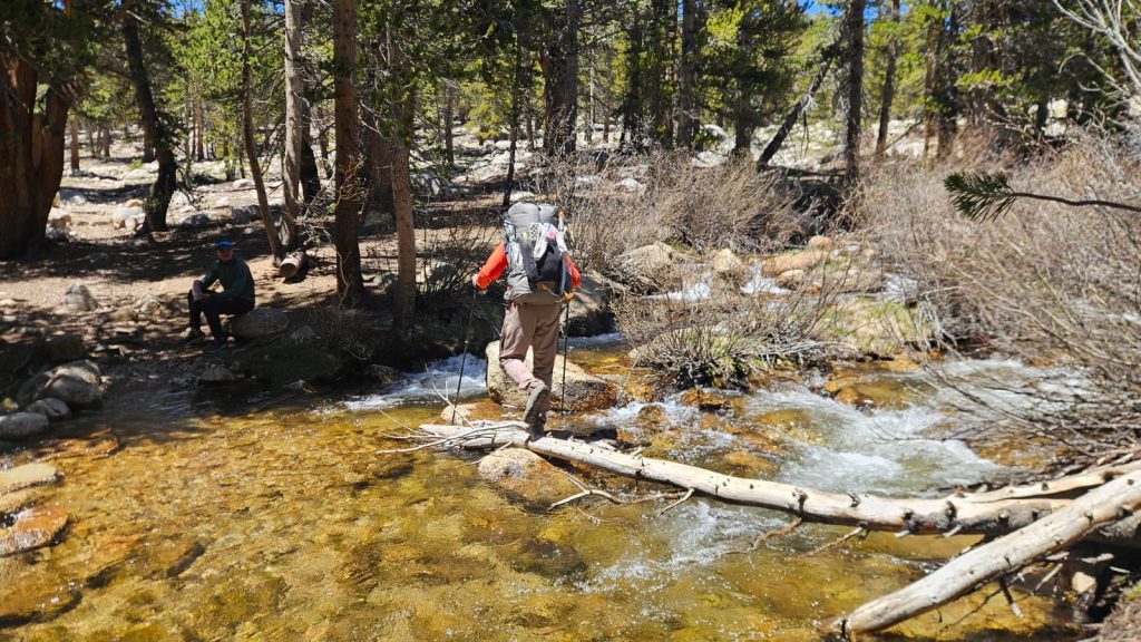
The hike today was beautiful high Sierra and at times left me without words. The first obstacle was Wallace Creek which I almost successfully navigated the rock hop across. I celebrated the dry crossing a little early and ended up with one wet shoe. Shortly after was Wright creek where I was successful at keeping both feet dry.
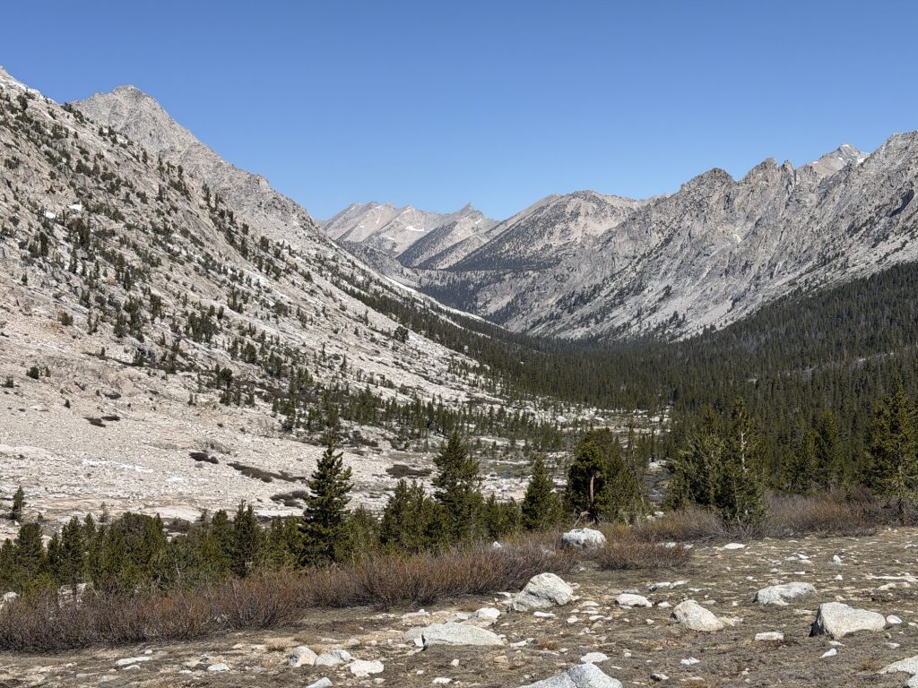
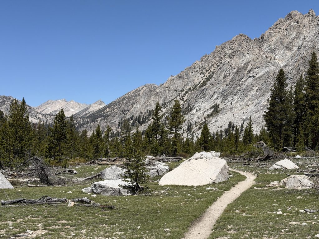
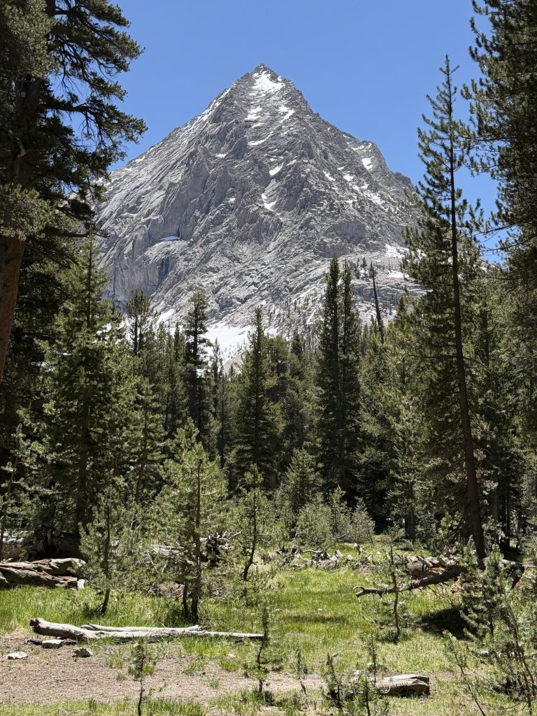
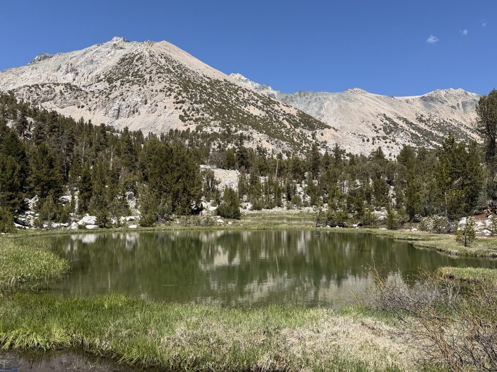
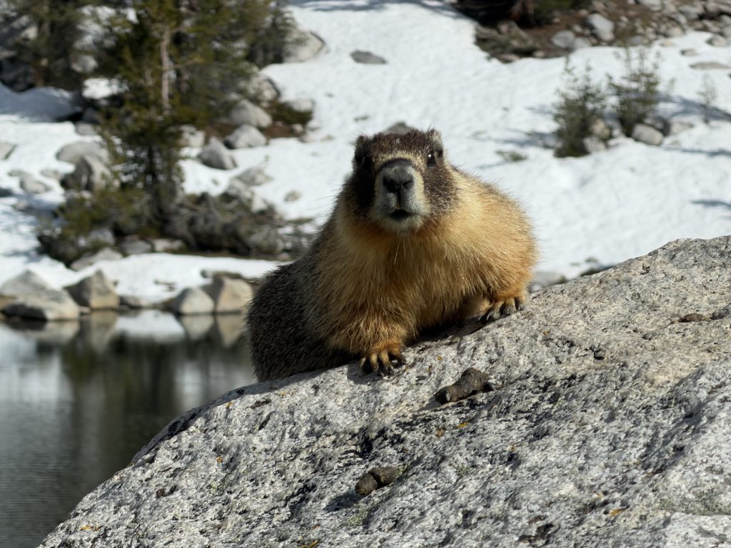
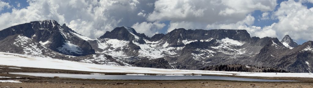
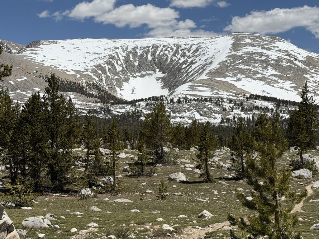
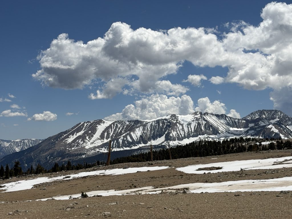
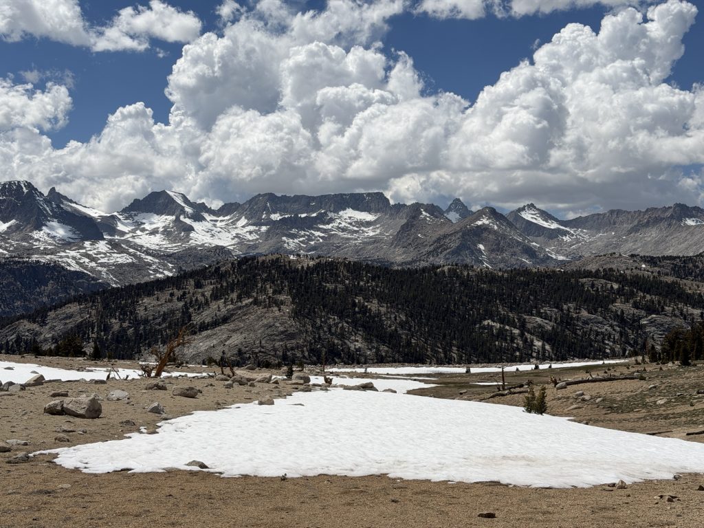
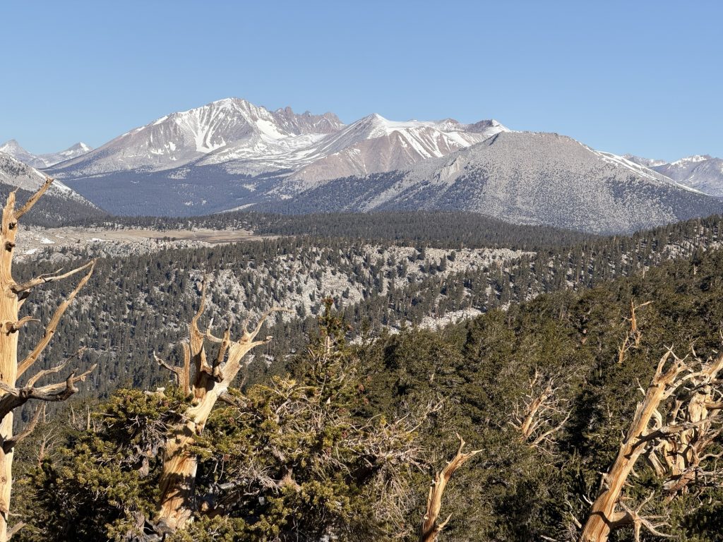
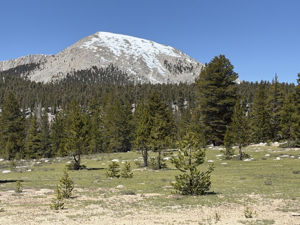
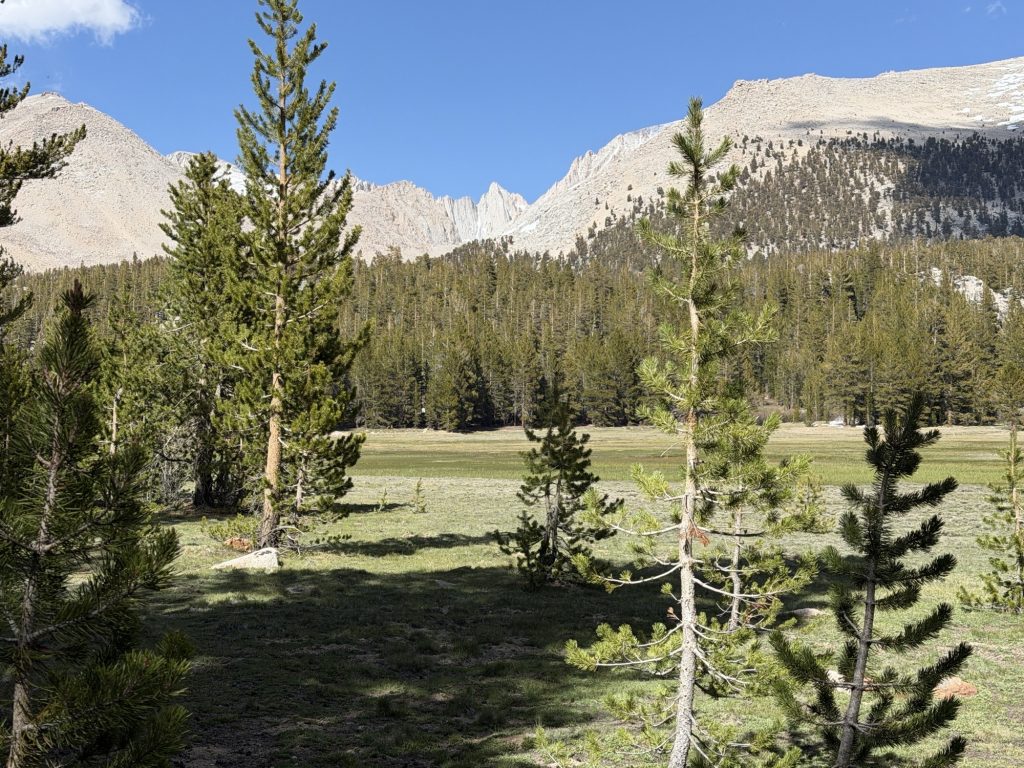
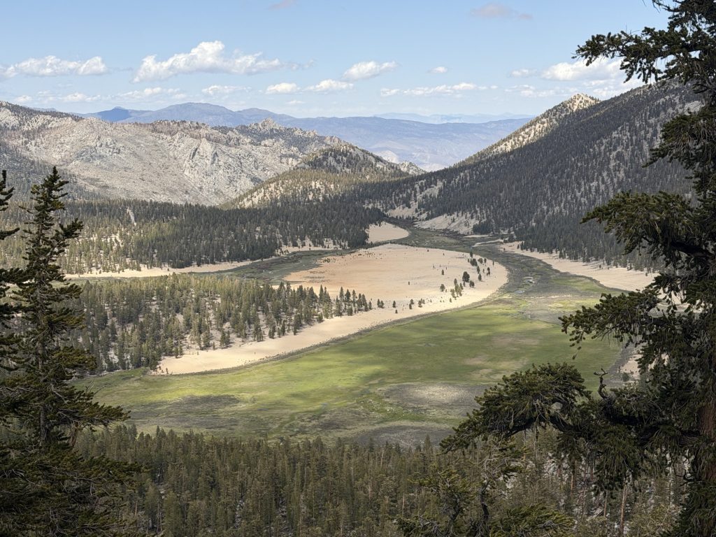
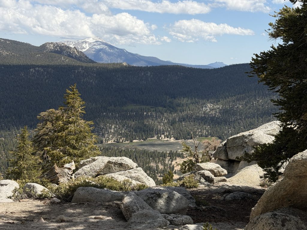
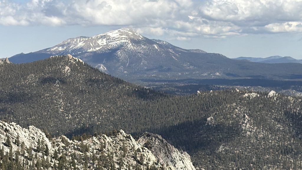
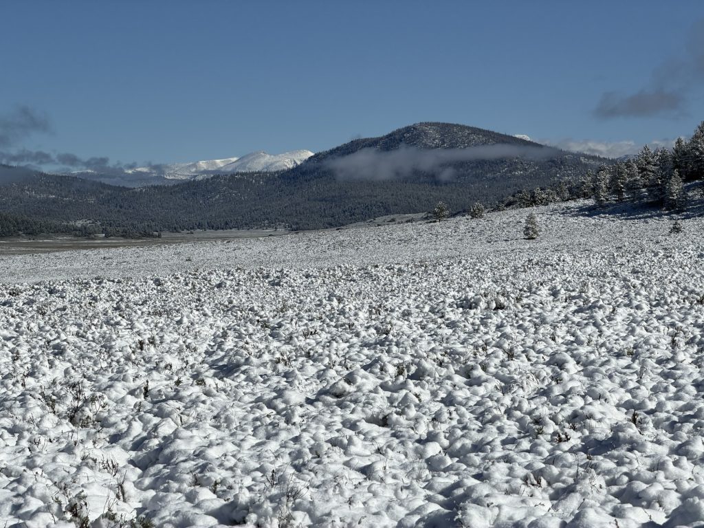
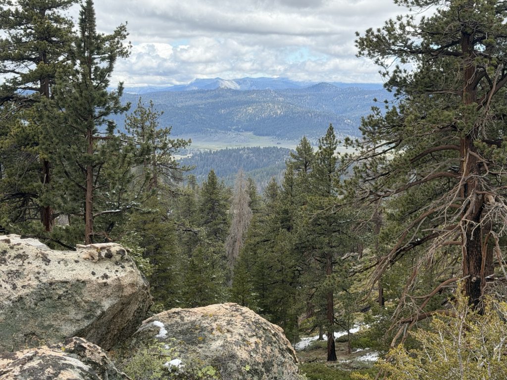
From here we climbed and with each step the Sierra became more and more beautiful Until we reached the Bighorn Plateau. I was greatful for the slow pace today that allowed us lots of time to take in the beautiful scenery. All around us Were mountains. In the rear we could still see Whitney and in front Forester Pass was came into view and in between nothing but mountains And marmots. I think we counted a dozen or so marmots running around the plateau. This is truly the Sierra and what everyone has been telling me to look forward to.
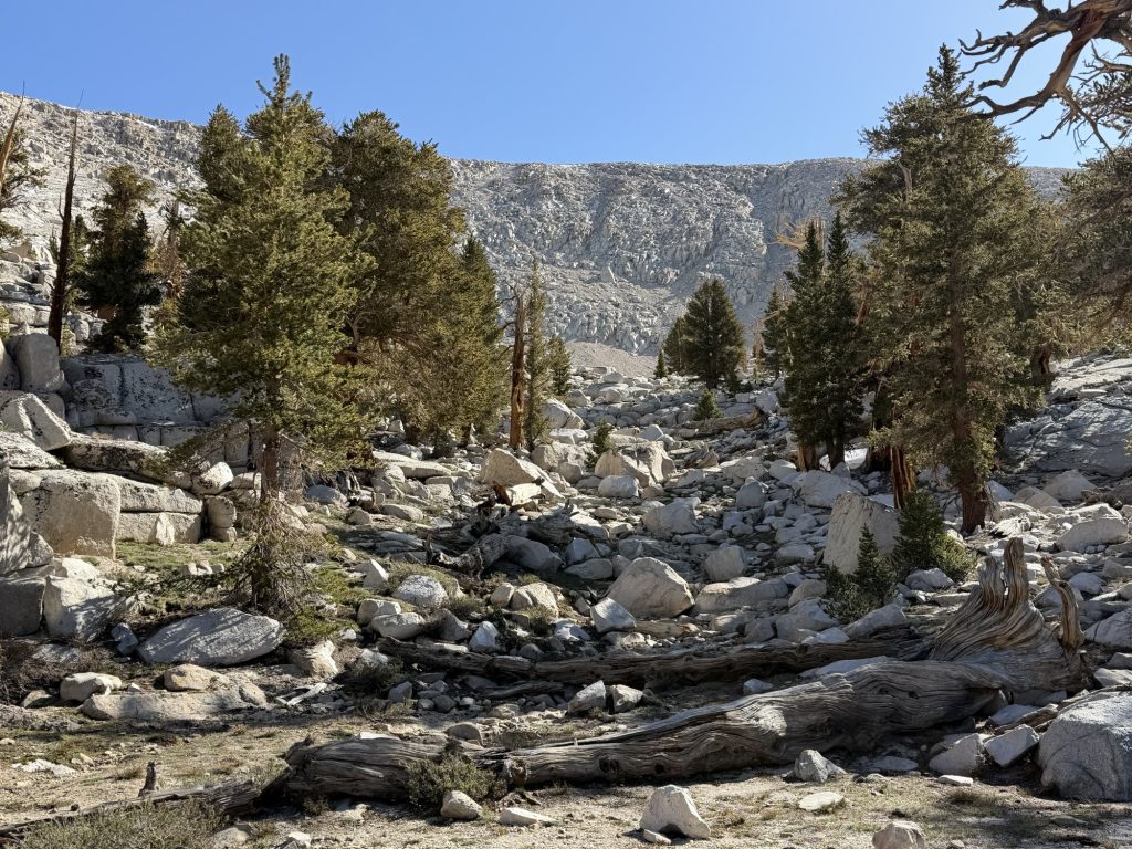
From here it was a short distance to Tyndall Creek in which there was no way for me to cross without getting my feet wet. So across I went, shoes on (this will suck tomorrow). The water was knee high and moving quickly. I can’t imagine what this creek looks like in a high snow year!
We arrived at camp at 1600 just as the sky began to darken and thunder could be heard from the direction we came. Fortunately we only got a few rain drops at our location.
Tomorrow will be an early start over Forester Pass, one I am actually nervous for. All the reports we have been able to get on trail don’t make it sound too bad. One of the hikers camped here has friends who bailed yesterday. They are in town and have spoken with PCT hikers who said we shouldn’t be concerned. I guess I’ll find out for myself soon enough.
Although I missed out on Whitney today was a great day. I don’t feel emotionally, mentally or physically exhausted. Now I can’t only do 8 PCT miles a day through the rest of the Sierra. But there sure is a better balance to be found. The rest of the group are hiking part way here today and will probably meet up with us tomorrow.
PCT Day 57 – PCT mile 750.7 to Crabtree Meadows (767.5)
May 31, 2026
Total PCT miles: 16.8
Non PCT miles: 1.1
Total: 17.9 miles / 28.8 km
Total elevation gain: 3094 ft
Total elevation loss: 3524 ft
Steps: 44070
Sleeping at elevation is not easy and often results in a poor outcome. Last night camped at 11119 ft, the highest we’ve been on the PCT so far, resulted in the worst sleep I’ve had on trail. Maybe 4 hours of broken, interrupted and not restful sleep. But at least the sun was out and hitting us at 0700 am warming us from the below freezing temperatures last night.
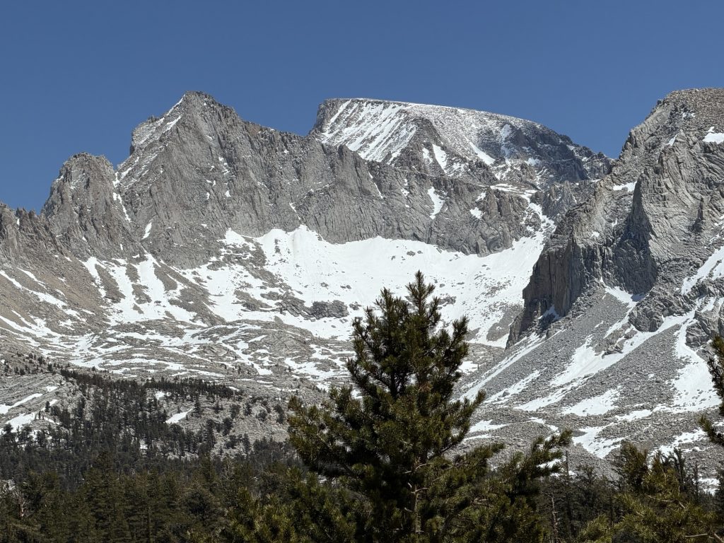
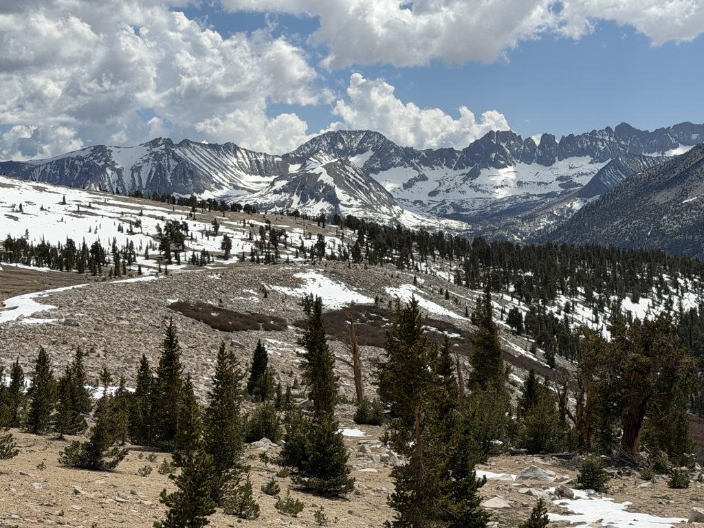
Today was another challenging day but as it progressed started to get more beautiful. It’s really starting to feel like we are in the High Sierra both in exertion levels required to move and in the beautiful landscapes.
We climbed almost to 12000 ft where we came across Chicken Spring Lake our first alpine lake. Apparently there is some sort of tradition to go swimming in it… but I had little desire to experience what hell freezing over actual feels like so I just continued on my way.
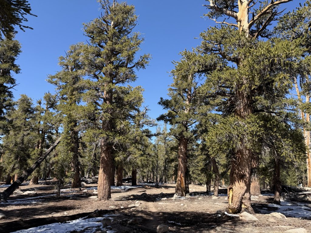
The forests here are interesting. Large pine and cedar trees with quite a bit of separation growing in sand or between rocks.
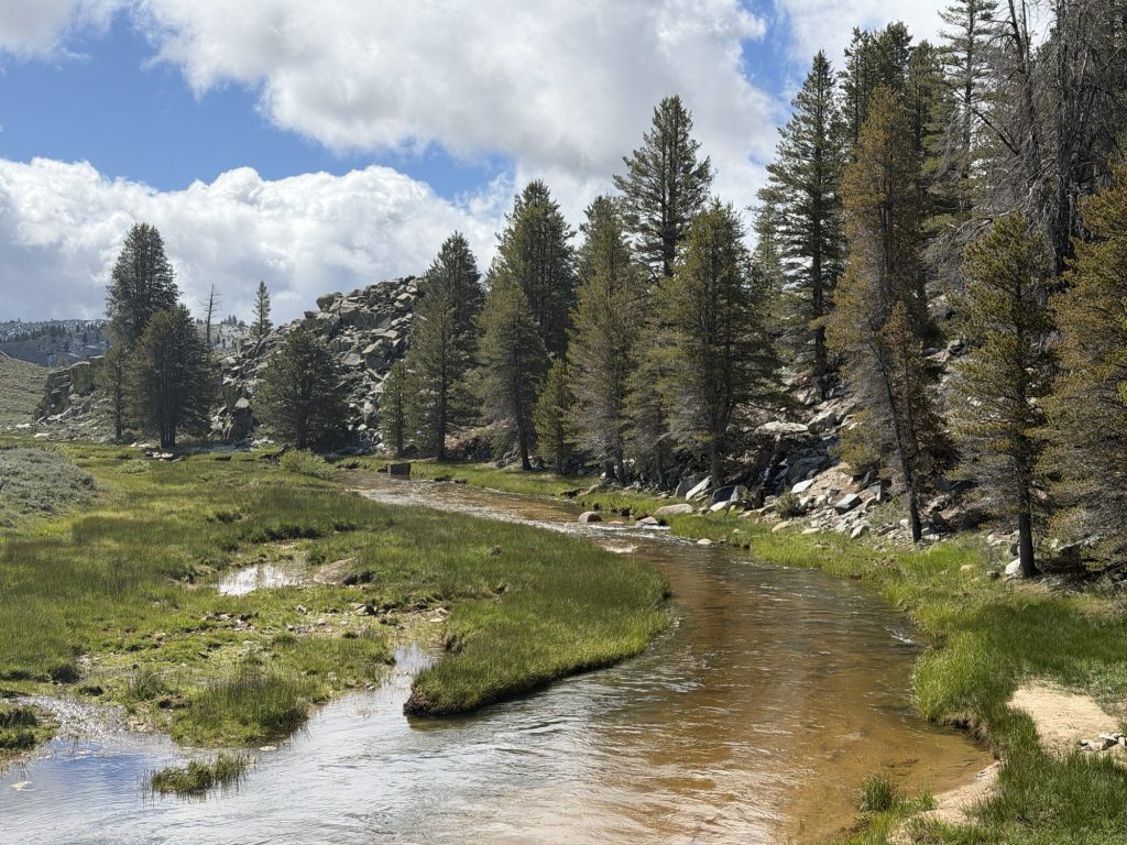
At times the trial provided beautiful views of green meadow valleys and the mountains in front. Today we had to cross our first two of many creek/river crossings on the PCT. The name of the game is keeping your shoes dry. The prize – dry feet. Rock creek was the first and fortunately there was a well placed narrow log that made the crossing easy. Whitney Creek was the second and rocks made it easy as well.
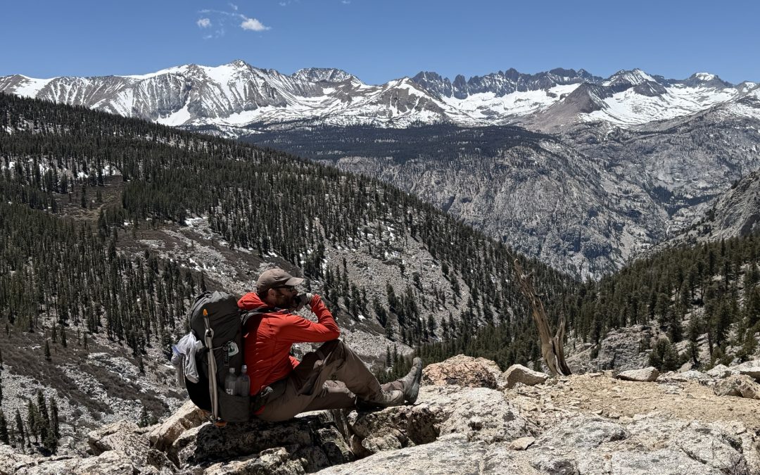
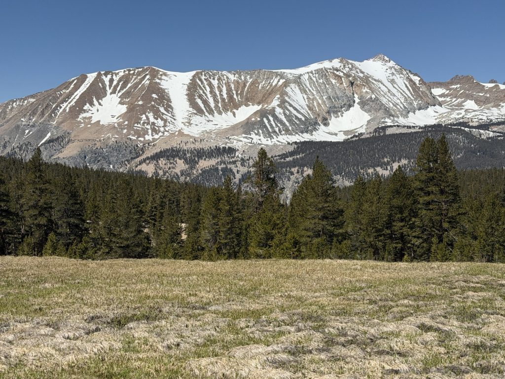
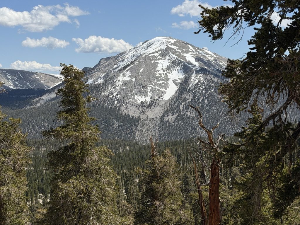
Coming down into Crabtree Meadows, the PCT gateway to Mount Whitney was beautiful. The view of Whitney and surrounding mountains was incredible.
Finished our hiking at 1700 and I am exhausted. Most of our group will hike to the Summit of Mount Whitney tomorrow but I am likley just going to take it easy. The elevation and miles have really taken a toll on my body the last few days and I probably should listen to it. Whitney is not part of the PCT, just a very popular optional side quest many hikers do. I had hoped to summit it, but not at any cost.
I have a strong dislike for the cold. Not very Canadian of me I know, but winter and sports are not words that generally go together in my vocabulary. Fortunately even with below freezing temperatures overnight I stay quite warm in my tent. It’s the getting out of my tent in the morning I have a particularly strong dislike of. The frozen fingers and frozen toes secondary to frozen shoes is particularly a strong dislike. Packing up the frozen tent because of frozen condensation is also not a lot of fun. Oh! How about filtering near freezing water! I know I’m making this adventure sound oh so very appealing aren’t I?
Regardless of all off this I actually slept fairly well last night. I even felt somewhat rested. We had another ambitious almost 19 miles planned for the day. These are big miles for the Sierra but at least the elevation profile didn’t appear to be as challenging as yesterdays.
We got the first climb out of the way right off the hop climbing to 10500 ft which provided some beautiful views of the Sierra mountains before us. Then a great view of Owen’s Valley where I had cell service! It was nice to call home and hear a friendly voice! It was here where one of the members of our group told us they was getting off trail and going home. It came as a shock to the group. I know what a difficult decision it is to leave the trail. But from what they said I’m sure they made the best decision for themselves.
Only 25-30% of people finish the PCT and that is because it’s hard. It’s easy to imaging all the ways it’s hard. But unless you’ve ever attempted a thru-hike you can never really know how grueling it actually is.
From here the trail descended back below 9500 ft. Its wild how just 1000 ft can make a difference in breathing and warmth. I found a nice meadow with a stream and had lunch and dried out my tent And sleeping bag. Yesterday I waited until I was at camp and there was little sun thanks to the clouds so I didn’t want to repeat that mistake.
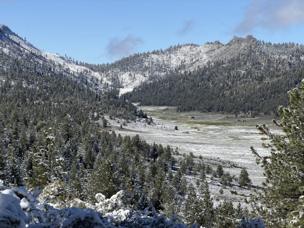
From here we climbed again up to 11119 ft where I am currently camped. Had a beautiful view of Horseshoe Meadow where I also got cell service briefly. I was making good time until the last two miles when my body finally had enough.
When I arrived at camp I suddenly out of nowhere and for no particular reason started crying.
Maybe it’s the exhaustion, maybe the elevation is getting to me. Maybe I miss home or I’m too much in my head. Maybe I just need a giant feast. Maybe having one of our group members decide to leave the trail made me think about leaving too. Or maybe it’s knowing it’s still only going to get harder over the next few days. Maybe the last two days I’ve failed to embrace the suck.
Really that’s all thru-hiking is… learning to thrive in the suck. Unless your watching someone on social media do one… they tend to edit out all the real suck.
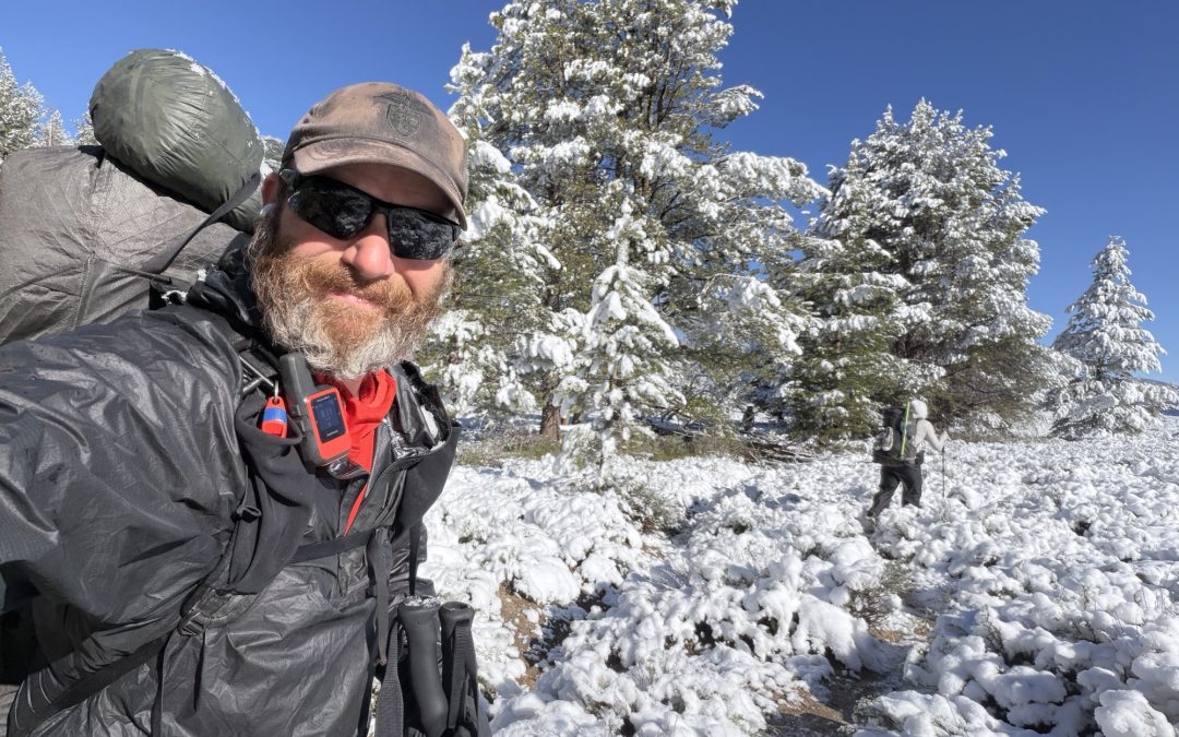
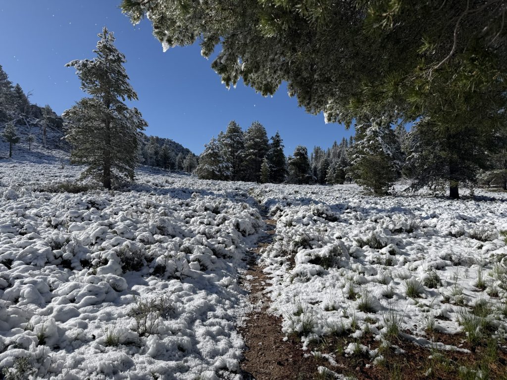
I woke up at 0100 hrs secondary to the call of nature. At some point the wet heavy snow had frozen and for a few moments I didn’t think I would be able to open the zipper. When I finally did I was greeted to a winter wonderland. It had stopped snowing… but we certainly got a lot more snow than was forecasted. I did my business and fell back asleep.
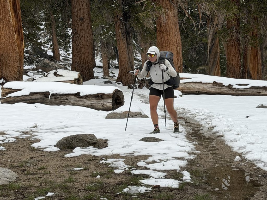
My alarm woke me up at 0630 and I had little desire to leave the comfort of my warm tent. It had gotten down to about -2 Celsius last night but inside my tent I was cozy. We had made the decision to start hiking around 0800 today to give the sun a chance to rise and start the process of meting the snow. The outside of my tent was covered in ice and snow but the inside was dry. So I separated the two and packed them in different bags in case I didn’t get a chance to dry everything out. Being cold is one thing but wet and cold is no good. Getting the ice off our tents proved to be challenging until the sun finally crested the hill and started providing some warmth.
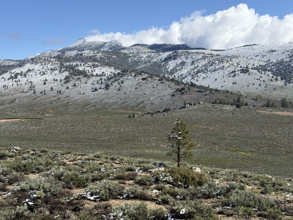
Now I’ve never winter camped in my life. In fact I think this is the first time I have camped in snow. I was not suprised to learn that I am not a fan. I will say the landscape was beautiful. But I’d much rather be warm than cold. Not very Canadian of me I supoose.
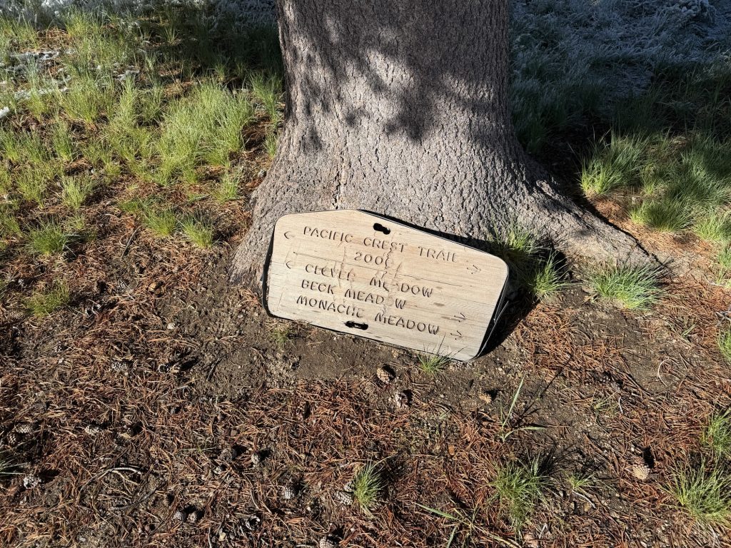
We set off shortly after 8 into our winter wonderland. Fortunately for some reason the trail itself had very little snow accumulation on it so we don’t have to route find. The first few miles were quite easy and we took a break at the Bridge that goes over the south fork of the Kern River.
From here we started to climb. My daily stats may not look super impressive. 18.2 miles and 3600 ft accent however because of the elevation it was probably one of the toughest days I’ve had so far on trail. We climbed up to 10500 ft and will only continue to go up over the next few days. We need to do about 18 miles a day to have a chance to summit Whitney As we all only have 7 days of food. If I’m being honest I’m not sure I can continue this pace but we will see what tomorrow brings.
As we climbed more of the trail became covered in snow or slush making for a nice ice bath for my feet. For a while we were even hiking in clouds. I was getting concerned on what our campsite tonight might look like. Would I have to set up on the snow!?!
Fortunately as we descended back towards 9000 ft it quickly became obvious that finding a dry camp would not be a problem. It didn’t even look like it had snowed on this side of the mountain. The views of the surrounding mountains were breathtaking… or was that just the elevation.
The US military seems to enjoy using the Sierra to fly jet fighters. All last night and today I could hear them but never saw one. Today I saw two flying quite close to the mountains. Looked like they were having more fun than I.
We arrived at camp at 1730 next to Death Canyon Creek. The name is fitting because I think we all feel dead and exhausted. Tomorrow is going to be another long day.